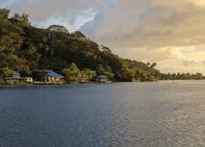
Hikes in Bora Bora reveal nature at its best.
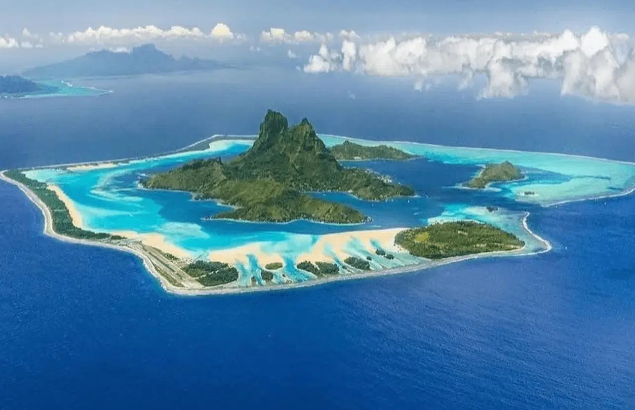
You can explore more than eight trails in Bora Bora along the turquoise lagoon and summits of the dormant volcanoes.
But what are the best hikes in Bora Bora? Let’s take a look.
KEY TAKEAWAYS:
- 🔰 Easy hike: The Mata Pupu Hike is a gentle, scenic walk with beautiful views of Matira Beach and the lagoon, perfect for beginners.
- 🏞️ Moderate hike: The Valley of the Kings is a rewarding hike with uneven terrain, cultural landmarks, and panoramic views of Mount Otemanu.
- 🧗 Challenging hike: The Mount Otemanu trail is one of the most difficult hikes in Bora Bora, with steep climbs and volcanic rock formations, best suited for experienced hikers with a local guide.
Dreaming of a French Polynesian vacation?
Fill in our SHORT FORM, and we will match you with trusted local tour operators who can build a personalized itinerary based on your STYLE, BUDGET, and TRAVEL DATES.
Our local partners create every itinerary with care. We kindly ask that you submit a request only if you’re considering traveling.
Overview of top 8 Bora Bora hiking trails
| Hike | Distance (miles/km) | Key feature |
| Valley of the Kings | 2.5 miles (4 km) | Ancient Polynesian archaeological sites and panoramic lagoon views |
| Mount Otemanu | 3.7 miles (6 km) | Panoramic views of the lagoon, Mount Pahia, and Motu Tapu |
| Mata Pupu Hike | 1.9 miles (3 km) | Panoramic views of Matira Beach, Mount Otemanu, and the lagoon |
| Bora Bora Loop | 20 miles (32 km) | Scenic coastal views, traditional marae, and WWII cannons |
| Mount Pahia | 4 miles (6.4 km) | 360° panoramic views of Bora Bora’s peaks and lagoon |
| Farepiti Cannons | 1.2 miles (2 km) | World War II-era cannons and views of Bora Bora’s main harbor |
| Point Fitiuu Cannons | 1.5 miles (2.4 km) | Higher-positioned WWII cannons with panoramic lagoon views |
| Faanui Cannons | 1.6 miles (2.5 km) | Secluded WWII cannons with jungle trails and lagoon glimpses |
Valley of the Kings
- Distance: 2.5 miles (4 kilometers) round trip
- Hiking time: 2–3 hours
- Elevation: 2,169 FEET (661 METERS)
- Time to reach by car: 15–20 MINUTES from most resorts in Vaitape
- Permit required: No
- Location: BORA BORA, FRENCH POLYNESIA
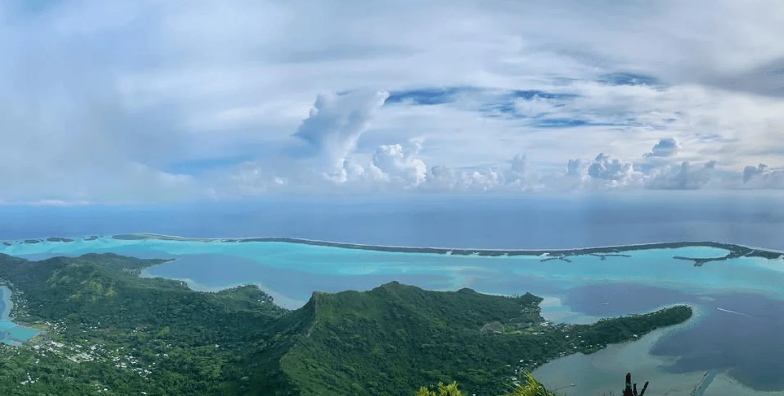
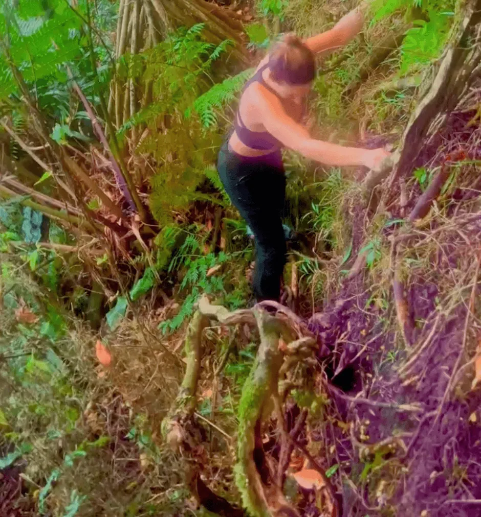
One of the most popular hikes in Bora Bora is the Valley of the Kings trail.
The Valley of the Kings hike begins near the village of Faanui, which is accessible by a short drive from most major resorts around Vaitape.
You’ll start the trail near an old dirt road that winds through dense jungle, surrounded by lush tropical vegetation and ancient Polynesian archaeological sites.
The trail is not always well-marked, so it’s recommended to go with a local guide who can point out historical landmarks, including marae (sacred temples) hidden along the path.
As you ascend, you’ll pass through thick groves of banana and breadfruit trees before reaching panoramic viewpoints overlooking Bora Bora’s lagoon and Mount Otemanu.
You can find more information on the Bora Bora map!
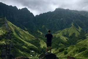
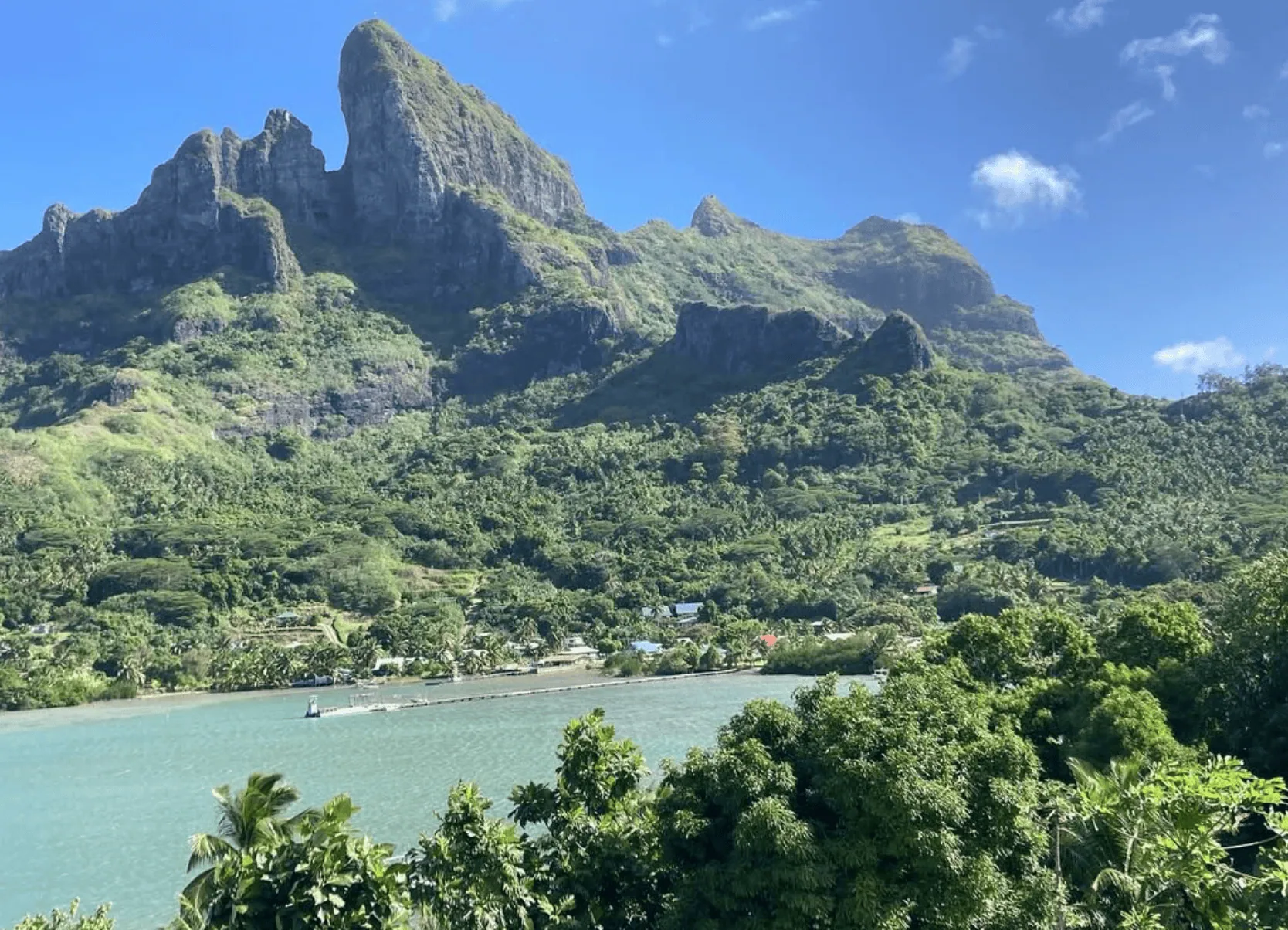
Mount Otemanu
- Distance: 3.7 miles (6 kilometers) round trip (to the base and back; summit access is not possible due to steep and unstable cliffs)
- Hiking time: 3–4 hours, depending on fitness level and trail conditions
- Elevation: 2,385 FEET (727 METERS)
- Time to reach by car: 10–15 MINUTES from most resorts in Vaitape
- Permit required: No, but hiring a guide is highly recommended
- Location: CENTRAL BORA BORA, FRENCH POLYNESIA
- Google Maps link: Mount Otemanu on AllTrails
This is one of the best hikes in Bora Bora; even Lonely Planet calls it the ‘best hike for bragging rights.’
TRIPADVISOR REVIEW: This mountain is what makes Bora Bora so special, without it would be just another pretty island. Mount Otemanu makes Bora Bora magical and the view of it is breathtaking.
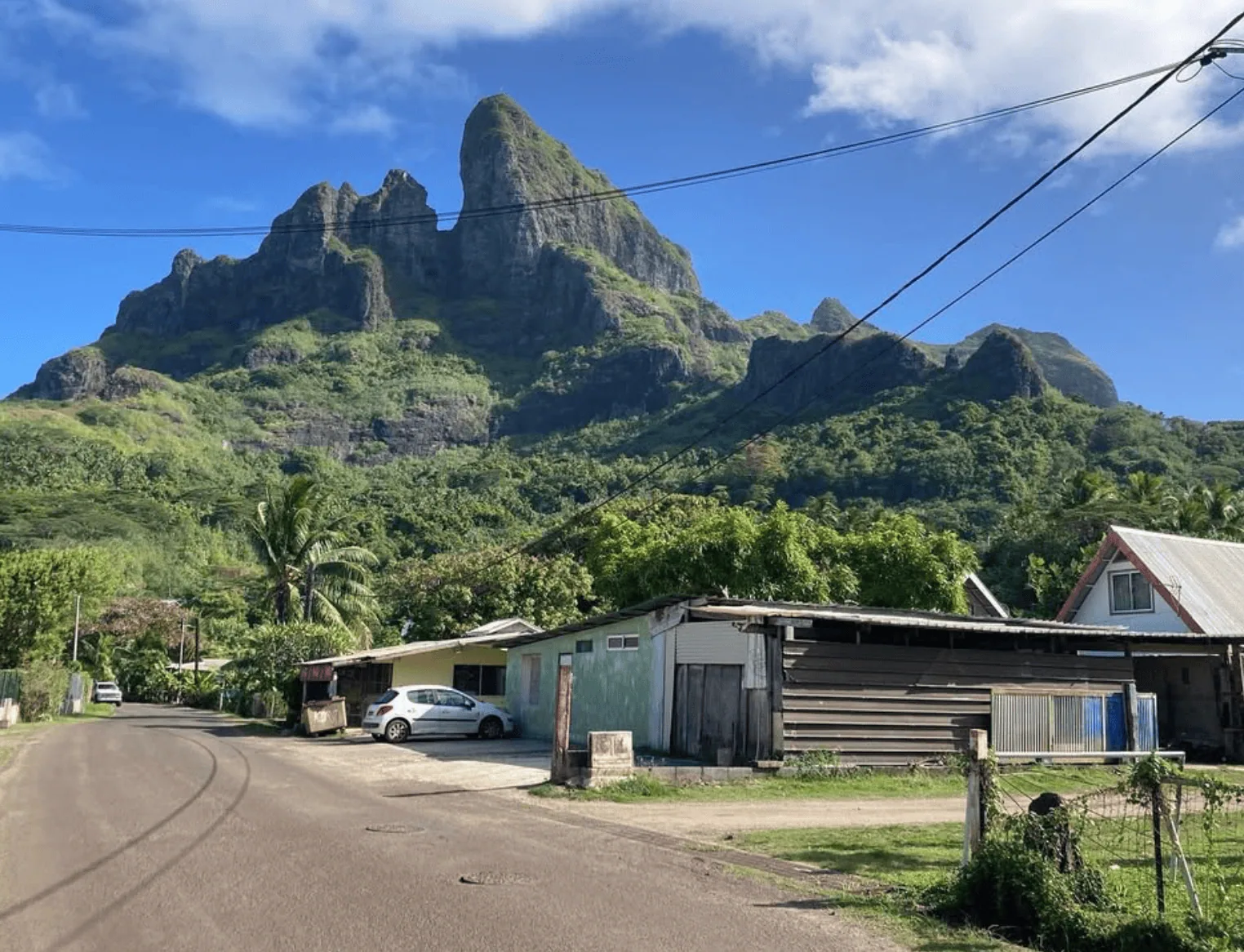
The Mount Otemanu hike begins near Anau Village on the eastern side of Bora Bora.
INTERESTING FACT: In the Tahitian language, the name “Otemanu” translates to “mountain that swallows people.”
The trail starts at the mountain’s base, accessible by a short drive from most major resorts around Vaitape.
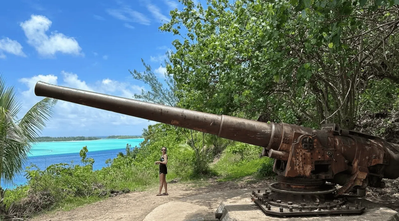
The first section follows a dirt road surrounded by dense tropical vegetation. You’ll pass remnants of old World War II cannons and bunkers (see below for more information).

The trail becomes steeper and rockier as you move deeper into the jungle.
The final ascent requires climbing over large volcanic rock formations and navigating through narrow ridges, making this one of the most challenging hikes in Bora Bora.
Unfortunately, reaching the SUMMIT IS IMPOSSIBLE due to the vertical cliffs and unstable volcanic rock. If you want to summit one of the best hikes in Bora Bora, we recommend doing the Pahia trail, where you can summit the volcano.
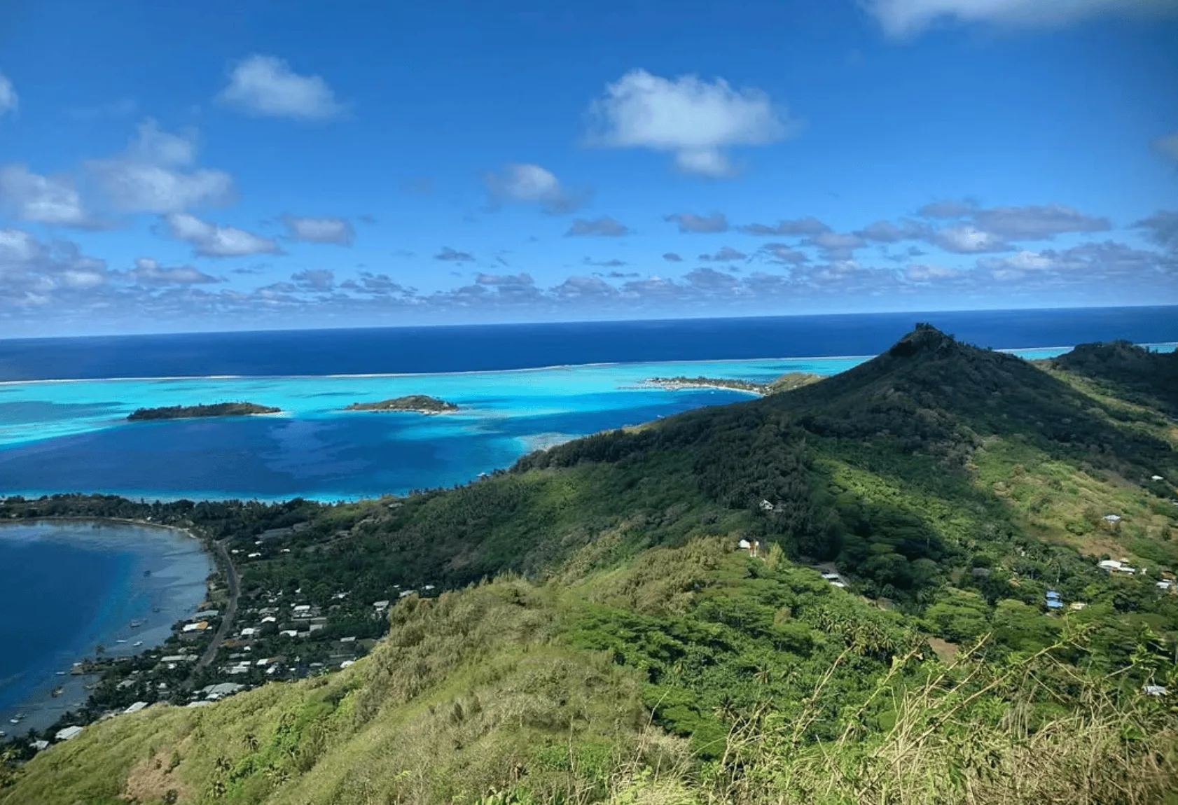
However, several lookout points offer breathtaking panoramic views of the lagoon, Mount Pahia, and the Motu Tapu islet.
TRIPADVISOR REVIEW: What started out as a medium-intensity hike with amazing views eventually got pretty hardcore, but it is capable for an average Joe as long as you are dressed right and willing to put in some work. At many points, it was so steep we had to use ropes to scale up. Once we got into the sacred cave and got to relax, it was amazing to take in the view.

Simply fill in the form below to get a FREE QUOTE from trusted local travel specialists who know the islands inside out.
It only takes 60 seconds, and you’ll receive custom itineraries and pricing directly in your inbox or WhatsApp within
48 hours.
Free of charge. No pressure. No obligation.
*Our trusted local partners create every itinerary with care. We kindly ask that you submit a request only if you’re considering traveling.
Mata Pupu Hike
- Distance: 1.9 miles (3 kilometers) round trip
- Hiking time: 1.5–2 hours, depending on fitness level and pace
- Elevation: 673 FEET (205 METERS)
- Time to reach by car: 10–15 MINUTES from most resorts in Vaitape
- Permit required: No
- Location: MATIRA POINT, BORA BORA, FRENCH POLYNESIA
- Google Maps link: Mata Pupu Hike on AllTrails
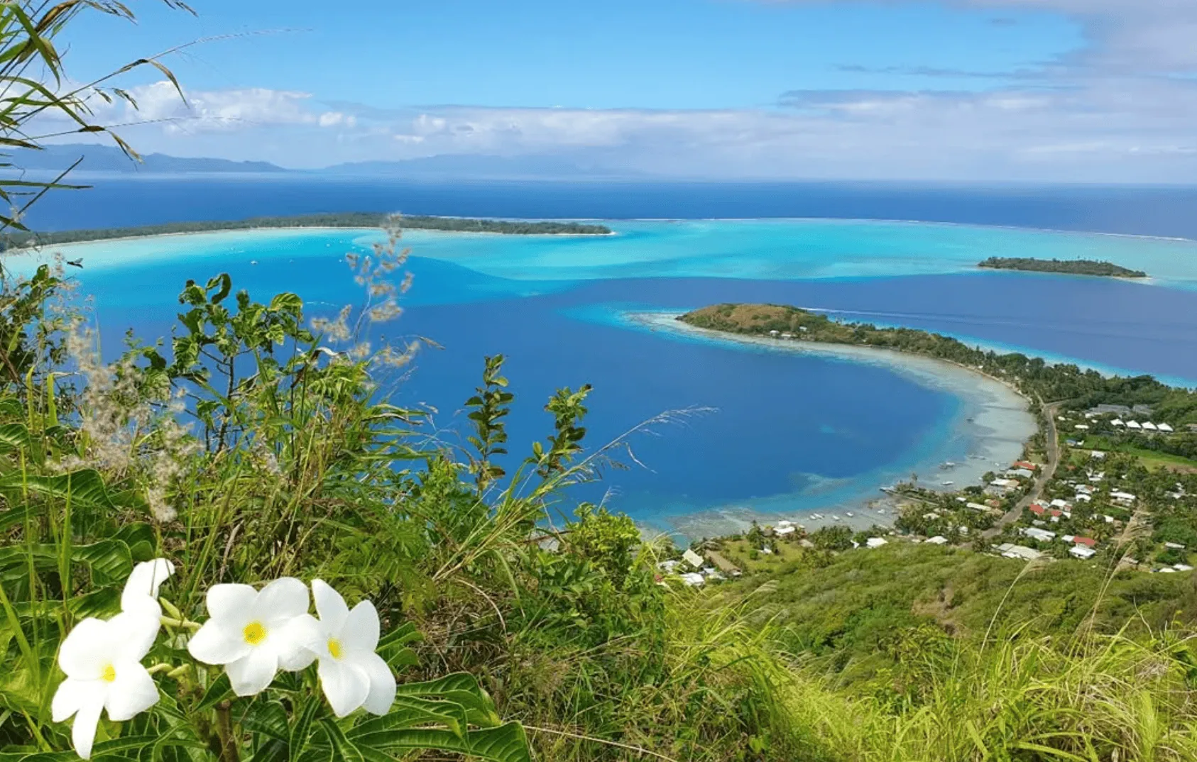
The Matira Pupu Hike begins near Matira Beach, Bora Bora’s most popular beach.
The trailhead is located at the island’s southern end, easily reachable by car, bike, or a short walk from nearby resorts.
This trail is famous for its easy slopes and is ideal for romantic couples looking for a scenic and relaxing walk.
The path winds through lush tropical vegetation, with occasional clearings offering spectacular views of Matira Beach, other stunning beaches, and the beautiful lagoon.
The trail gradually ascends, leading you to a small ridge with panoramic views of Mount Otemanu and Matira Point. It’s a perfect spot for Instagram-worthy pictures.
Bora Bora Loop
- Distance: 20 miles (32 kilometers) for the loop
- Hiking time: 6–8 hours on foot or 2–3 hours by bike, depending on fitness level and number of stops
- Elevation: Up to 394 FEET (120 METERS )
- Time to reach by car: Accessible from most resorts around Vaitape in 5–10 MINUTES
- Permit required: No
- Location: CIRCULAR ROUTE AROUND BORA BORA, FRENCH POLYNESIA
- Google Maps link: Bora Bora Loop on AllTrails
The Bora Bora Loop is a full-circle trail around the main island, following the coastal road (Ring Road), which spans 32 kilometers (20 miles).
This loop isn’t a traditional hiking trail but offers a scenic walk or bike ride to explore Bora Bora’s perimeter on foot or by bicycle.
Starting from Vaitape, the island’s main village, you can follow the paved road clockwise or counterclockwise, passing by small villages, lush jungles, dense forests, and stunning coastal viewpoints.
The route offers views of the lagoon and iconic peaks like Mount Otemanu and Mount Pahia.
Along the way, you’ll encounter public beaches, traditional marae (Polynesian temples), local eateries, and World War II cannons left behind by American forces.
While the terrain is mostly flat, minor elevation gains near Faanui Bay and Matira Point make the trail manageable for most fitness levels.
You can hike sections of the loop or complete the full circle, which can take 6–8 hours on foot or 2–3 hours by bike.
Mount Pahia
- Distance: 4 miles (6.4 kilometers) round trip
- Hiking time: 3–4 hours
- Elevation: 2,169 FEET (661 METERS)
- Time to reach by car: 10–15 MINUTES from most resorts in Vaitape
- Permit required: No, but a local guide is strongly recommended
- Location: CENTRAL BORA BORA, FRENCH POLYNESIA
- Google Maps link: Mount Pahia on AllTrails

The Mount Pahia hike begins just outside Vaitape and is considered one of the most rewarding hikes on the island.
BEWARE: This trail is only for experienced hikers.
The trailhead starts near a small dirt road through thick, dense vegetation.
The early section of the trail is easy, with gradual inclines and occasional clearings that offer views of the surrounding lagoon.
As you ascend, the trail becomes much steeper and more rugged, requiring you to navigate over exposed roots, volcanic rock formations, and narrow ridges.
The final stretch demands scrambling skills and is best tackled with the help of a local guide who can safely lead you to the summit.
From the top, you’ll be rewarded with 360-degree panoramic views of Bora Bora’s iconic peaks, including Mount Otemanu, the surrounding Motu Tapu islets, and the turquoise lagoon.
Farepiti Cannons
- Distance: 1.2 miles (2 kilometers) round trip
- Hiking time: 1 – 1.5 hours
- Elevation: 98 FEET (30 METERS)
- Time to reach by car: 10 MINUTES from most resorts in Vaitape
- Permit required: No
- Location: FAREPITI POINT, BORA BORA, FRENCH POLYNESIA
The Farepiti Cannons hike is a short, historical walk that begins near Farepiti Wharf, just a few minutes’ drive from Vaitape.
The trail starts at a dirt path branching off from the main road and quickly leads you uphill through light tropical vegetation.
This is one of the best hikes in Bora Bora. It is more of a stroll than a challenging climb, making it ideal for a romantic stroll.
As you ascend, you’ll reach the World War II-era cannons, remnants of the U.S. military presence on the island.
These massive artillery pieces were installed to protect Bora Bora’s lagoon from potential invasions.
The Point Fitiuu Cannons are positioned higher above Faanui Bay, where the Fitiuu cannons are located. This provides broader panoramic views of the lagoon and surrounding motus.
You’ll enjoy stunning views of the lagoon and nearby Mount Otemanu from the cannon sites.
Simply fill in the form below to get a FREE QUOTE from trusted local travel specialists who know the islands inside out.
It only takes 60 seconds, and you’ll receive custom itineraries and pricing directly in your inbox or WhatsApp within
48 hours.
Free of charge. No pressure. No obligation.
*Our trusted local partners create every itinerary with care. We kindly ask that you submit a request only if you’re considering traveling.
Point Fitiuu Cannons
- Distance: 1.5 miles (2.4 kilometers) round trip
- Hiking time: 1–2 hours
- Elevation: 164 FEET (50 METERS)
- Time to reach by car: 10–15 MINUTES from most resorts in Vaitape
- Permit required: No
- Location: POINT FITIUU, BORA BORA, FRENCH POLYNESIA
The Point Fitiuu Cannons hike begins just outside the village of Faanui, accessible by a short drive from most major resorts around Vaitape.
This short trail features a moderate incline and leads to a collection of World War II cannons placed by the U.S. military to protect Bora Bora’s strategic lagoon during the war.
The hike starts on a dirt road that winds through dense jungle foliage, offering intermittent views of the lagoon and nearby islets.
The trail becomes steeper as you continue, with some rocky sections requiring careful footing.
The cannons are remarkably well-preserved and offer insight into Bora Bora’s wartime history.
GOOD TO KNOW: The Farepiti Cannons are closer to Farepiti Wharf and offer views of Bora Bora’s main harbor.
Faanui Cannons
- Distance: 1.6 miles (2.5 kilometers) round trip
- Hiking time: 1.5 – 2 hours
- Elevation: 197 FEET (60 METERS)
- Time to reach by car: 10 MINUTES from most resorts in Vaitape
- Permit required: No
- Location: FAANUI BAY, BORA BORA, FRENCH POLYNESIA
- Google Maps link: Faanui Cannons on AllTrails
The Faanui Cannons are different from the Farepiti and Point Fitiuu Cannons because they are located deeper within Faanui Bay and require more secluded jungle trails to reach them.
The Faanui Cannons hike begins near Faanui Bay. The trail starts on a dirt path that quickly ascends through lush jungle vegetation, with several clearings offering glimpses of the lagoon below.
This is one of the best hikes in Bora Bora with a moderately steep incline, making it accessible for most fitness levels while providing a rewarding workout.
At the summit, you’ll reach a series of World War II cannons, remnants of the U.S. military defenses installed during the war.
When to go hiking in Bora Bora
The best time to go on hikes in Bora Bora is during the dry season, which runs from May to October.
This period offers cooler temperatures, lower humidity, and minimal rainfall, creating ideal hiking conditions.
Average daytime temperatures range from 24°C to 28°C (75°F to 82°F), making it comfortable for longer hikes without the risk of overheating.
Why avoid the wet season?
The wet season runs from November to April, bringing heavy rainfall, high humidity, and a greater risk of tropical storms.
The hikes in Bora Bora become muddy and slippery, so always wear proper hiking boots if you attempt hikes.
Mosquito activity is also higher during this time, especially in dense jungle areas like the Valley of the Kings and around Faanui Bay.
Best time of day for hiking
Regardless of the season, early morning or late afternoon hikes in Bora Bora are the best times to avoid the hottest part of the day.
Starting your hike before 8 AM or after 4 PM offers cooler temperatures and better lighting for photography—especially if you’re hiking to capture views of Mount Otemanu or the stunning lagoon sunsets.

What to take for hikes in Bora Bora
Being prepared is essential for a safe and enjoyable hiking experience in Bora Bora.
Here’s a complete list of essentials to pack:
Clothing and footwear
- Lightweight, breathable clothing: Quick-dry fabrics are ideal due to the island’s humidity.
- Long-sleeve shirts and pants: To protect against sunburn and insect bites.
- Sturdy hiking shoes or trail runners: The terrain can be slippery, especially on trails like Mount Pahia or Mount Otemanu.
- Wide-brimmed hat and sunglasses: For sun protection.
Gear and accessories
- Backpack: A small, comfortable daypack with padded straps.
- Reusable water bottle: At least 2 liters (68 oz) for longer hikes. Drinking plenty of water is crucial.
- Insect repellent: Essential for jungle trails like the Valley of the Kings.
- Sunscreen: SPF 50+ to protect against intense tropical sun.
- Map or GPS device: Some trails, like Mount Pahia, are poorly marked, so navigation tools help prevent getting lost.
- Trekking poles: Useful for steep or rocky ascents, especially on challenging hikes like Mount Otemanu.
- First aid kit includes plasters, antiseptic wipes, and personal medications.
Simply fill in the form below to get a FREE QUOTE from trusted local travel specialists who know the islands inside out.
It only takes 60 seconds, and you’ll receive custom itineraries and pricing directly in your inbox or WhatsApp within
48 hours.
Free of charge. No pressure. No obligation.
*Our trusted local partners create every itinerary with care. We kindly ask that you submit a request only if you’re considering traveling.
FAQ
Does Bora Bora have hiking trails?
Yes, Bora Bora offers several scenic hiking trails, including challenging treks like Mount Otemanu and Mount Pahia, as well as historical walks to World War II cannons in Faanui and Point Fitiuu.
Is there a waterfall in Bora Bora?
No, there are no natural waterfalls in Bora Bora. However, nearby islands like Tahiti and Moorea are known for their stunning waterfalls if you’re looking for a day trip adventure.
Can you walk around Bora Bora?
Yes, you can walk around the island using the Bora Bora Loop, a 32-kilometer (20-mile) coastal road. While possible on foot, biking is a more convenient way to explore the island’s perimeter.