Are you looking for the best hiking trails in Cleveland Ohio?
Then look no further! Let’s delve into which trails are the best for hiking in Cleveland!
KEY TAKEAWAYS:
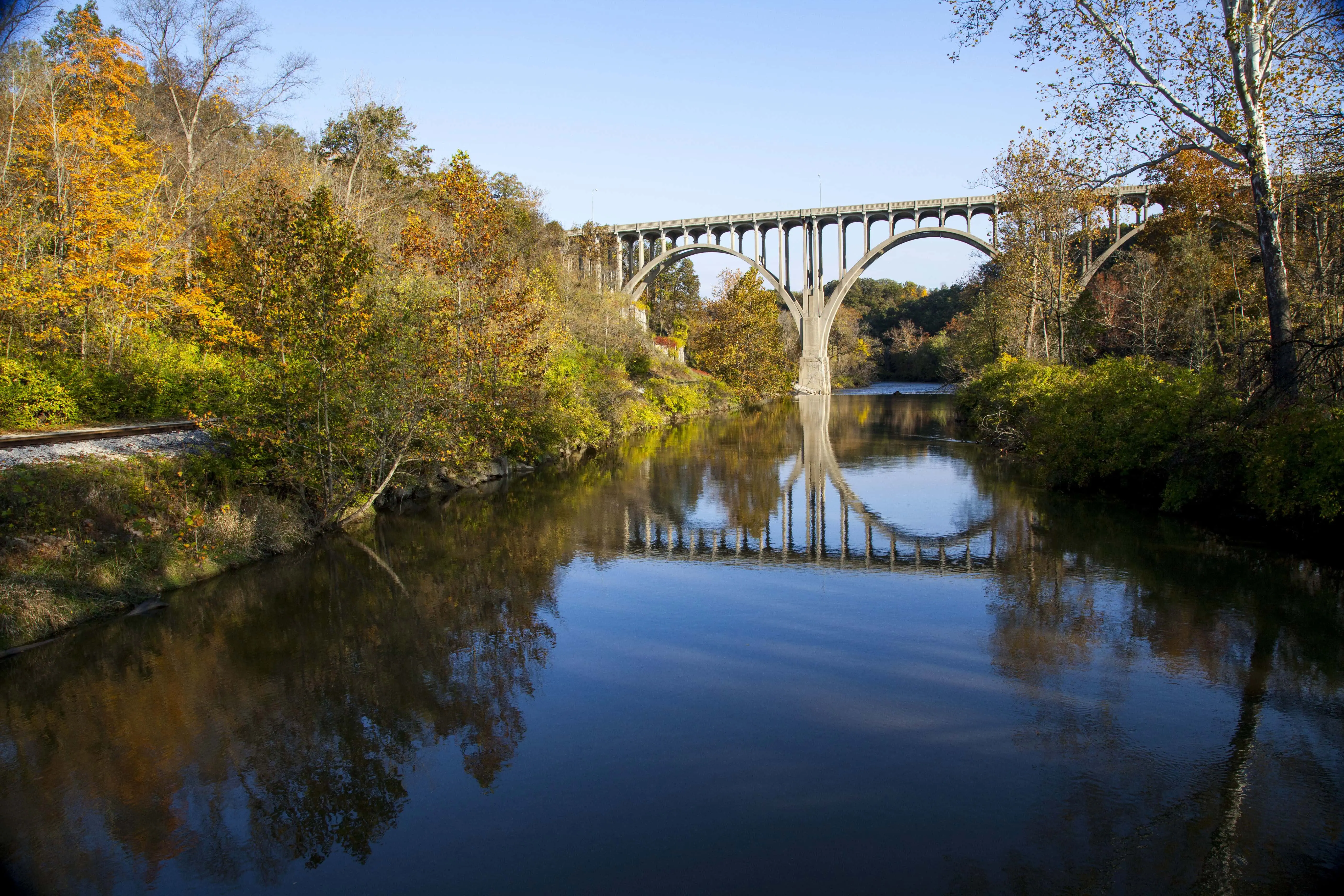
Overview of hiking trails in Cleveland Ohio
Cleveland sits at the crossroads of two green parks: the Cleveland Metroparks system (known as the Emerald Necklace) and the Cuyahoga Valley National Park.
Both parks are visit-worthy with amazing trails. Cuyahoga Valley National Park is home to over 125 miles of trails, and the Cleveland Metroparks system also has hundreds of miles of trails.
You’ll find everything from nearly-level boardwalk paths to rugged woodland climbs.
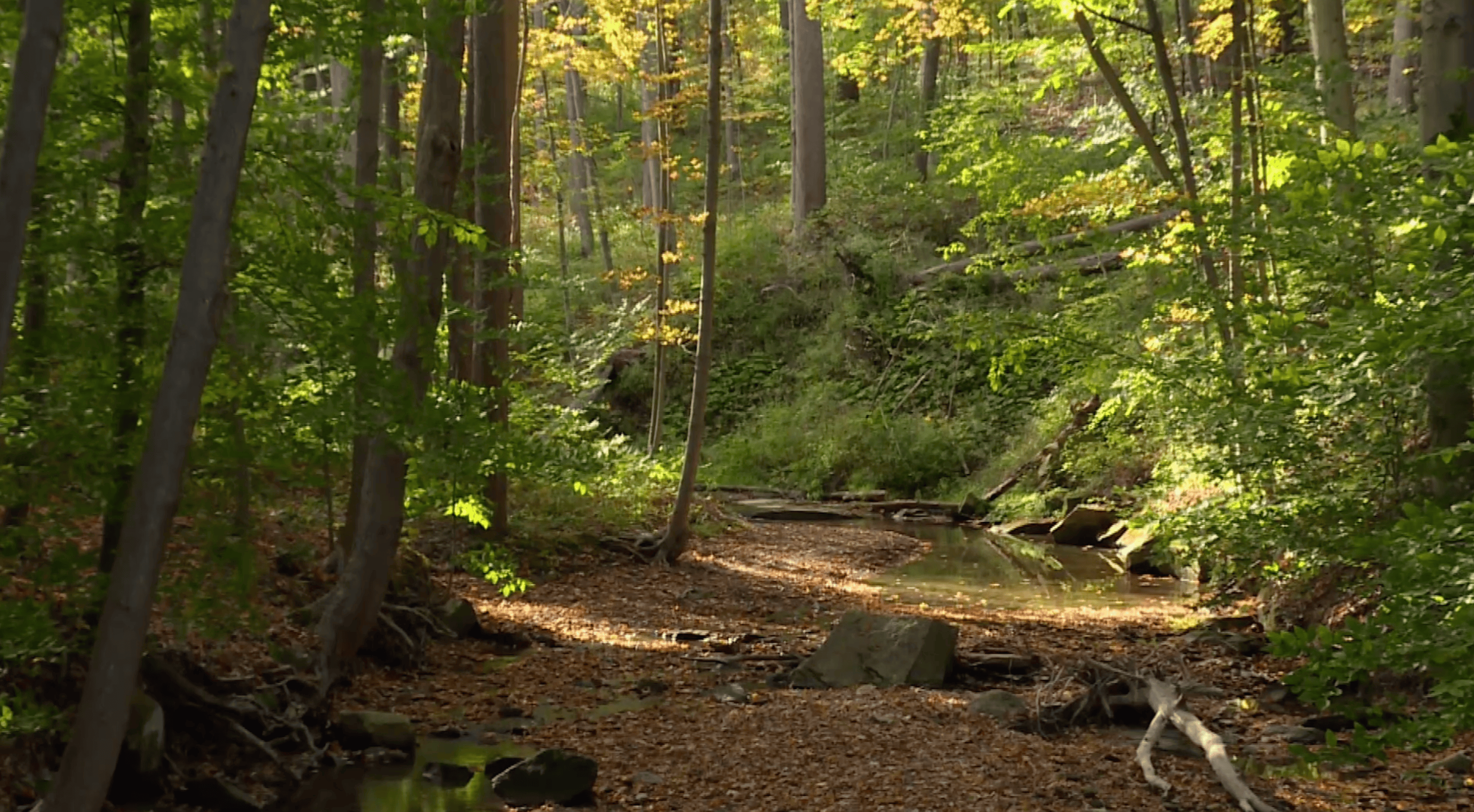
The trails take you through lush woodlands, quiet wetlands, and open fields, offering a chance to spot wildlife and seasonal plant life along the way.
This is the ONLY NATIONAL PARK IN OHIO, and it’s less than a 30-minute drive from downtown Cleveland.
Let’s take a look at the overview of the best trails for hiking in Cleveland!
| Cleveland hiking trail | Sightseeing highlights | AllTrails Link |
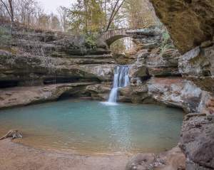
| Deer Lick Cave Loop | Berea sandstone rock overhang “cave”; Deer Lick Falls (small waterfall); ravines & beech-maple forest | AllTrails Page |
| Brandywine Falls Trail (Brandywine Gorge Loop) | 60-ft Brandywine Falls (tallest in the Cleveland National Park); boardwalk overlook; carved gorge amphitheater | AllTrails Page |
| Squire’s Castle & Buttermilk Falls | 1890s stone castle gatehouse (ruin); Buttermilk Falls (15-ft cascade) with observation deck; second-growth forest | AllTrails Page |
| The Ledges Trail (CVNP) | Sandstone cliffs Ritchie Ledges & narrow passages; Ledges Overlook (panoramic valley view); Ice Box Cave (closed for bats) | AllTrails Page |
| Blue Hen Falls Trail | 15-ft Blue Hen Falls (fan-shaped waterfall) in wooded ravine; footbridge viewpoint; option to continue to upstream Buttermilk Falls (unofficial) | AllTrails Page |
| Bridal Veil Falls & Tinker’s Creek Gorge | 20-ft tiered Bridal Veil Falls over shale; Tinker’s Creek Gorge scenic overlook (220-ft deep glacial gorge) | AllTrails Page |
| Henry Church Rock Loop (Squaw Rock) | Henry Church Rock 1885 carving on riverside boulder; stone staircases into Chagrin River gorge; small cascades/rapids | AllTrails Page |
| Whipp’s Ledges | Sandstone ledges up to 30 ft high; rock scrambling through passages; hilltop views over Hinckley Reservation | AllTrails Page |
| Euclid Creek Reservation Trails | Wooded valley trails along Euclid Creek; shale ledges & small waterfalls; sycamore-lined gorge, autumn foliage reflections | AllTrails Page |
| Chapin Forest Reservation | Forest paths through pines & maples; exposed sandstone ledges; scenic overlooks of Lake Erie and the Cleveland skyline | AllTrails Page |
| Penitentiary Glen Reservation (Gorge Rim Loop) | Rugged shale gorge trails with hidden overlooks, spring wildflowers, and seasonal waterfalls after rains | AllTrails Page |
| Hell Hollow Wilderness Area (Beech Ridge Loop) | Deep 100-ft Paine Creek gorge; 262-step wooden staircase to creek; secluded forest setting, trillium in spring | AllTrails Page |
| Mill Creek Falls Trail | Mill Creek Falls (48-ft tallest Cuyahoga County waterfall); urban wooded trail; viewing deck at falls | AllTrails Page |
| Fairport Harbor Lakefront Park | Lake Erie beach park; historic lighthouse views (Fairport Harbor Light); sunset panoramas over lake | (Not on AllTrails) |
Now, let’s dive in!
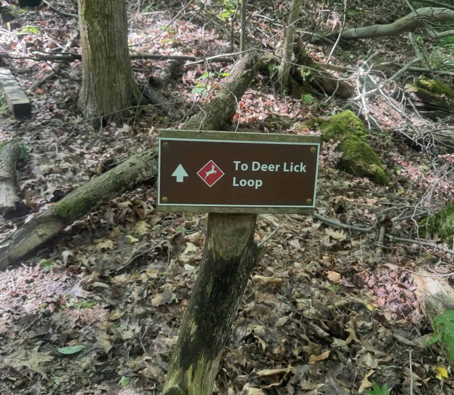
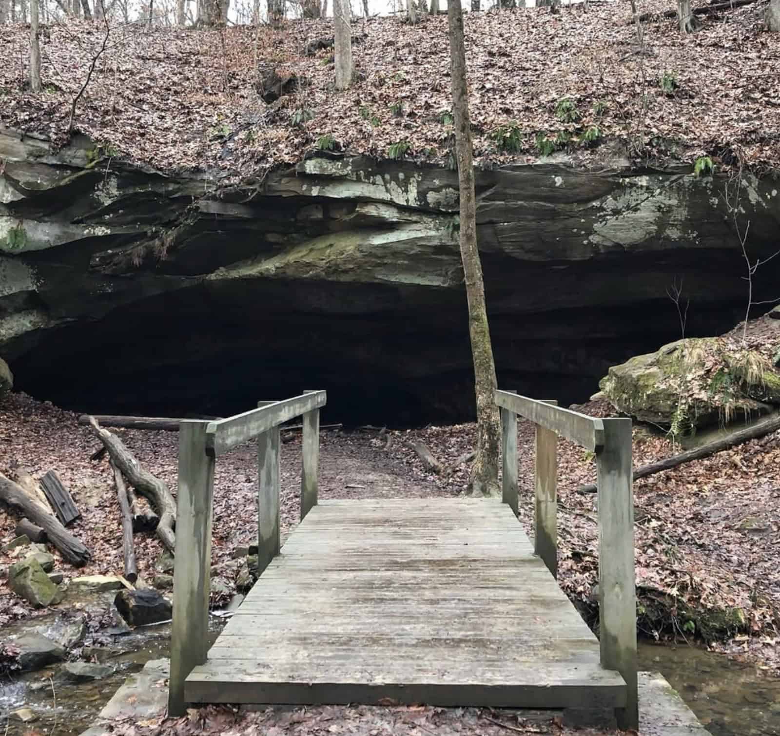
Deer Lick Cave Loop
Hidden in the forests of Brecksville Reservation, Deer Lick Cave (AllTrails Page) is not a true cave, but a huge Berea Sandstone rock overhang. It’s the best trail for hiking in Cleveland!
It’s a recess carved by water over millennia, according to clevelandmetroparks.com.
Early settlers noticed white-tailed deer gathering here to lick the salt that leached out of the ancient ocean salt deposits in the sandstone, giving the cave its name!
The loop trail is a scenic 4-mile adventure that takes you deep into ravines and ridgetops of the Emerald Necklace.
👉 DID YOU KNOW: It’s one of the most visited park districts in the nation. In 2020, the Metroparks recorded 19.7 million recreational visitors, according to news5cleveland.com! In fact, Cleveland Metroparks earned the National Gold Medal “Best in Nation” Award in 2021 for its excellence in park management.
Starting near the Brecksville Nature Center, the trail drops down 60 wooden steps into the valley of Chippewa Creek.
You’ll follow small paths alongside bubbling creeks, cross footbridges, and wind through a cathedral of beech-maple forest, according to freshwatercleveland.com.
A spur leads to the massive Deer Lick Cave overhang. You can step underneath the overhang to enjoy the sandstone ceiling and sometimes even the dripping water or icicles, depending on the season.
In wet months, a small waterfall (Deer Lick Falls) trickles over the edge of the rock shelter.
From the cave, the loop continues, at times coinciding with the famed 1,400-mile Buckeye Trail (watch for blue blazes).
The terrain is rugged in spots, so expect a few short steep hills, wooden staircases, and rooty sections that remind you this is a true hike, not a casual stroll.
Despite being in suburban Cleveland, parts of this loop feel almost primeval and remote.
You might catch glimpses of the ravine’s cliffs through the trees, or even forget the city is nearby.
👉 KEEP IN MIND: This trail gets muddy after rain (wear boots you don’t mind getting dirty).
Overall, Deer Lick Cave Loop is one of the best hiking trails in Cleveland Ohio.
Practical details:
- Trail type: Loop, ~4.0 mi (6.4 km). Follows Deer Lick Cave Loop Trail and Buckeye Trail in a circle.
- Difficulty: Moderate, several ups and downs (about 500 ft total elevation gain), staircases, and uneven terrain. Not wheelchair or stroller accessible.
- Time needed: ~1.5 to 2 hours to complete the loop.
- Trailhead: Deer Lick Cave Trailhead parking (off Chippewa Creek Drive, Brecksville, OH) or Brecksville Nature Center (off Chippewa Creek Dr.). The Nature Center has restrooms, water, and maps; starting there adds a short connector trail (with stairs) to reach the loop.
- Dog-friendly? Yes, dogs on leash are welcome. Be prepared for muddy paws and some steep sections where you may need to hold the leash securely.
- Best time: Spring brings wildflowers and high creek flow. BUT autumn offers stunning fall colors in the gorge. In winter, icicles hang from Deer Lick Cave’s ledges, according to clevelandmetroparks.com.
TRIPADVISOR REVIEW: “There were some horses on the trail! There are beautiful stream crossings and a great trail. Didn’t feel too difficult and went by fast 🙂“
Take a look at the best places to stay near Deer Lick Cave Loop!
Brandywine Falls Trail

Brandywine Falls Trail (AllTrails Page) is home to the TALLEST waterfall in Cuyahoga Valley National Park, the 60-foot Brandywine Falls!
The trail begins on a wooden boardwalk leading you to an overlook of the falls, revealing a beautiful geological amphitheater carved by the Brandywine Creek.
In spring and after heavy rains, Brandywine Falls has an impressive flow; in winter, it can freeze into an Instagram-worthy ice sculpture.
The Brandywine Gorge Trail loops down into the wooded gorge, following the creek past mossy boulders and hemlock groves.
The path then ascends gradual switchbacks back to the trailhead, completing a 1.5-mile loop. It’s an easy-to-moderate hike with some stairs, suitable for most hikers.
👉 KEEP IN MIND: Brandywine Falls is hugely popular – often cited as the most popular hike in the park.
Practical details:
- Trail type: Loop, 1.5 mi (2.4 km) total. Begins with a boardwalk to the falls overlook, then a dirt/gravel trail through the gorge back.
- Difficulty: Easy to Moderate – mostly gentle with some stairs and one hill.
- Time needed: ~1 to 1.5 hours for the full loop (or 20–30 minutes round-trip to just see the falls from the boardwalk).
- Trailhead: Brandywine Falls parking area on Brandywine Road (Sagamore Hills). No fees or permits. Restrooms are available at the trailhead.
- Dog-friendly? Yes, leashed dogs are allowed on the trail.
- Best time: Spring and after heavy rain for peak flow; fall for beautiful foliage in the gorge; winter to see the falls frozen. The trail can be icy in winter – use caution.
👉 INSIDER TIP: Always be insured during your hikes! There’s a company called SafetyWing that we swear by. It’s insurance designed with digital nomads in mind. It covers you in over 180 countries, and it’s quite affordable, starting at $56.28 (ages 18-39) per month. It covers not just emergency situations, but you can, for example, visit a doctor if you have the flu, and it also includes the prescribed drugs. Use the widget below to discover your price!

Henry Church Rock (Squaw Rock) Loop
This short but action-packed trail (AllTrails Page) in South Chagrin Reservation features art, history, and nature all in one.
The main attraction is Henry Church Rock, a carving chiseled into a massive riverside boulder in 1885 by artist Henry Church Jr.

The rock bears images of a woman, a serpent, a moon, and other symbols.
Getting there is half the fun: from the Squaw Rock picnic area, the trail descends a stone staircase into the gorge of the Chagrin River.
At the bottom, you’ll follow a dirt path alongside the rushing river, seeing the large sandstone boulder with the carvings.
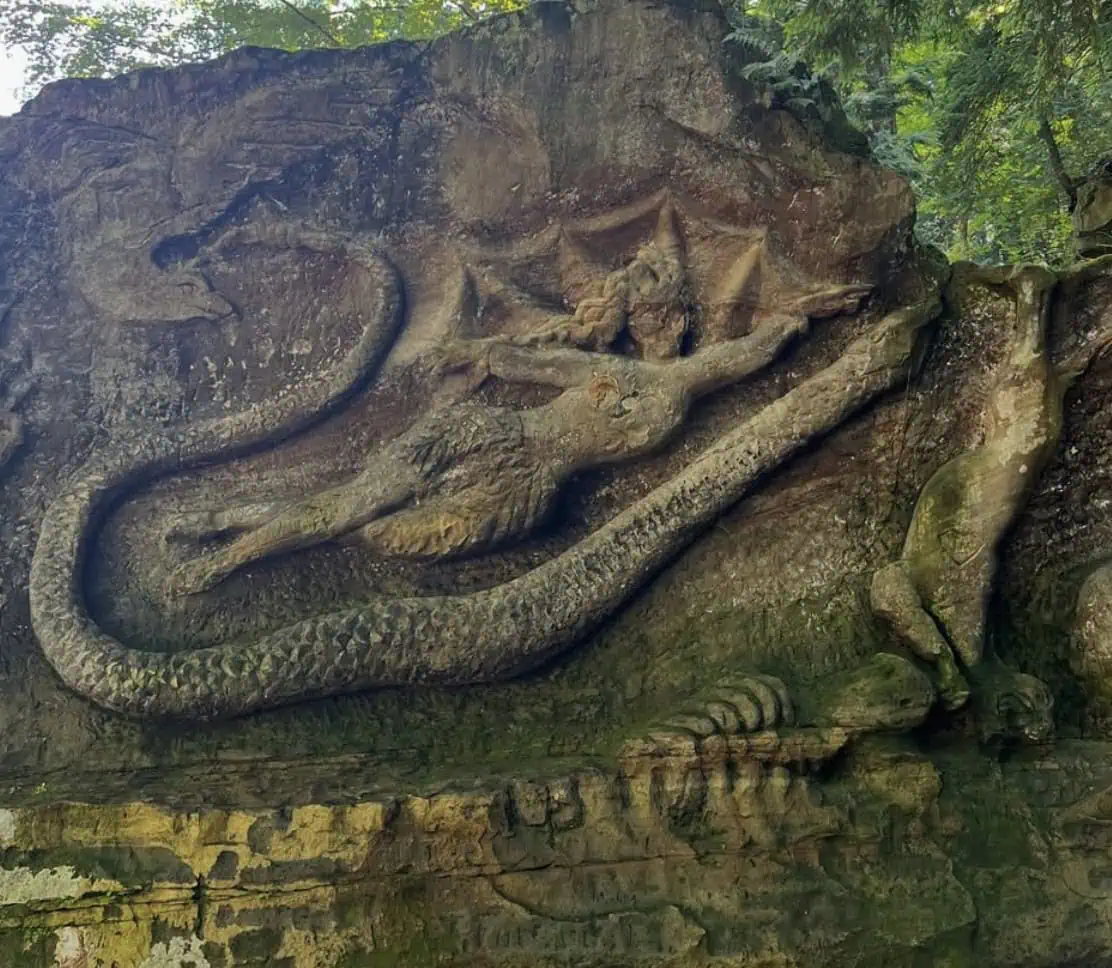
It’s amazing to think of an artist spending months here in the 19th century, carving by hand.
Just beyond the carving, the Chagrin River tumbles over a series of ledges, creating a small waterfall and rapids that add to the scenery.
The trail continues across a wooden footbridge to the opposite bank, then loops back upstream.
You’ll climb another set of stairs to return to the top of the gorge, completing a 0.6-mile loop.
This trail is frequently mentioned among Cleveland’s best hikes for an easy outing because it packs a lot of payoff in a short distance.
Practical details:
- Trail type: Loop, ~0.6 mi (1.0 km). Natural surface path down and up the gorge; includes two staircases.
- Difficulty: Easy – short distance. Moderate effort only in that you must climb back up ~50+ stone steps. Overall suitable for all ages (with hand-holding for young children on steps).
- Time needed: ~30 minutes. Allow extra time to examine Henry Church Rock and enjoy the riverside.
- Trailhead: Squaw Rock Picnic Area (Henry Church Rock Trailhead) on Hawthorn Parkway, Bentleyville, OH. There is a parking lot, picnic tables, and a restroom at the trailhead.
- Dog-friendly? Yes, dogs on leash are permitted. Most dogs handle the stairs fine; smaller dogs may need a carry on steep parts.
- Best time: Year-round. Spring brings high water flow in the river; autumn adds beautiful colors along the gorge. Winter is unique if you catch the river partially frozen and icy formations on the rock carving. Summer is lush and shaded (great on a hot day).
Squire’s Castle & Buttermilk Falls
This hike (AllTrails Page) combines a storybook castle ruin with a tranquil waterfall, showcasing the diverse attractions of North Chagrin Reservation.
Squire’s Castle is a beautiful stone gatehouse from the 1890s, modeled after European castles, according to clevelandmetroparks.com.
Start your adventure here: wander through the empty castle (it’s open and unfurnished inside).
Once you’ve explored the castle’s archways and winding staircase, hit the trail that leads into the woods toward Buttermilk Falls.
Following the Castle Valley Trail and a short segment of the Bridle Trail, you’ll hike through a beautiful second-growth forest.
In about 1.5 miles, you’ll reach Buttermilk Falls, a lovely 15-foot cascade formed by Buttermilk Creek as it tumbles over shale bedrock, according to naturalohioadventures.com.
True to its name, the water fans out in a smooth, white curtain.
A wooden observation deck provides a safe, up-close view of the falls and the mossy gorge around it.
You can even hear the “buttery” smooth flow of the creek as it gurgles past.
Buttermilk Falls is a moderate flow waterfall; it swells impressively in wet weather, but slows to a gentle trickle during dry spells.
The surrounding hemlock ravine keeps it cool and scenic year-round.
After enjoying the falls, you’ll retrace your route back to Squire’s Castle, completing an out-and-back hike of roughly 3 miles.
Practical details:
- Trail type: Out-and-back, ~3.0 mi (4.8 km) total (from Squire’s Castle to Buttermilk Falls and back). Follows Castle Valley Trail/Bridle Trail combo.
- Difficulty: Easy to Moderate. The path is largely wide and dirt/gravel (former carriage roads), with gentle hills. No steep climbs; just watch for muddy patches.
- Time needed: ~1 to 1.5 hours round-trip (plus time spent at the castle and falls).
- Trailhead: Squire’s Castle parking area, off River Road/Chagrin River Road in Willoughby Hills, OH. Large parking lot, open field, and restrooms available. The castle is right by the parking, and the trail to Buttermilk Falls starts just east of the castle grounds.
- Dog-friendly? Yes, leashed dogs are welcome.
With an extensive network of trails (plus a national park next door), it’s no surprise that hiking in Cleveland is a favorite activity for locals.
👉 DID YOU KNOW: Locals often refer to the Metroparks as the “Emerald Necklace” because these green spaces ring around the city?
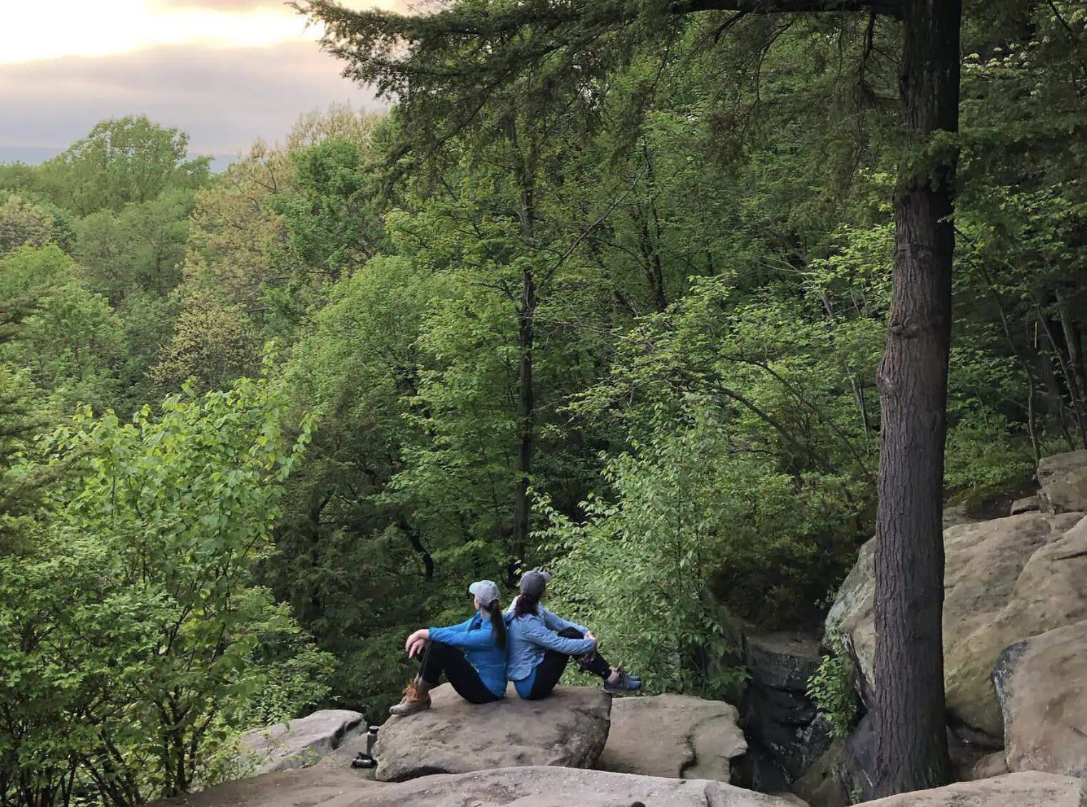
The Ledges Trail
This iconic loop (AllTrails Page) winds through the Ritchie Ledges, a maze of sandstone cliffs and narrow passages that showcase Ohio’s geologic history.
Under a canopy of oak and hemlock, you’ll scramble between moss-covered boulders and squeeze through rock crevices that stay cool even in summer.
Midway, the trail leads to Ledges Overlook, a rocky outcrop with a panoramic view over the Cuyahoga Valley. It’s a perfect spot for sunsets and Instagram pictures!

Along the route, signs highlight how these cliffs were formed by ancient seas and glaciers.
You’ll also pass the gated mouth of Ice Box Cave, a cave tucked in the ledges.
👉 KEEP IN MIND that this cave is CLOSED to protect the bats from white-nose syndrome.
Many hikers rank the Ledges among the best hiking trails in Cleveland Ohio, for its mix of nature and adventure.
Practical details:
- Trail type: Loop, ~2.2 mi (3.5 km). Dirt path circling the ledge formation.
- Difficulty: Easy to Moderate, short and mostly flat, but with uneven rocky sections and some stone steps. Suitable for most skill levels.
- Time needed: ~1.5 to 2 hours. You’ll want to pause at viewpoints and explore the nooks and crannies of the ledges.
- Trailhead: Ledges Trailhead on Kendall Park Rd. (Peninsula, OH). Picnic area and restrooms at the trailhead parking.
- Dog-friendly? Yes, dogs on leash are allowed.
Blue Hen Falls
Hidden away in a ravine, the Blue Hen Falls (AllTrails Page) is a 15-foot waterfall that plunges over a sandstone ledge into a rocky pool.
The hike to reach it follows a segment of the Buckeye Trail (marked with blue blazes), descending through shady hardwood forest.
After about 0.5 miles, you’ll hear the sound of water and arrive at the wooden footbridge and viewing area for Blue Hen Falls.
This fan-shaped waterfall is especially captivating after rainfall, when it fans out over the rock in multiple ribbons.
Unlike Brandywine, Blue Hen has a more serene beauty. That’s one of the reasons many hikers cherish it as a peaceful retreat away from larger crowds.
The trail is short but does involve some steep and uneven sections, with wooden steps built into the hillside.
Sturdy footwear is recommended, as there are roots and occasional mud on the path.
👉 INSIDER TIP: For an extra dose of adventure, you can continue past Blue Hen Falls along an unofficial footpath to discover Buttermilk Falls, a more secluded cascade upstream (only attempt if you’re sure-footed and don’t mind a rugged, unmarked route). Blue Hen Falls itself, however, is an easily accessible gem and one of the best “secret” trails for hiking in Cleveland.
Practical details:
- Trail type: Out-and-back, ~3.0 mi (4.8 km) round-trip from Boston Mill Visitor Center (via Buckeye Trail). If starting at the closer trailhead on Boston Mills Road, it’s about 1.5 miles round-trip.
- Difficulty: Moderate, it’s a short distance but includes a steep hill and stairs on a dirt trail. Some rocky footing. Take it slow on the ascent back up.
- Time needed: ~1 to 1.5 hours (from Boston Mill VC). From the nearer trailhead, ~30–45 minutes round trip.
- Trailhead: Park at Boston Mill Visitor Center (Peninsula, OH) for a longer hike, or at the small pull-off on Boston Mills Rd (east of Riverview Rd) for the shorter direct route. No restrooms at the small pull-off; facilities available at Boston Mill VC.
- Dog-friendly? Yes, leashed dogs permitted. Note the stairs and stream crossings if bringing pets.
Bridal Veil Falls & Tinker’s Creek Gorge
If you’re craving both a waterfall and a grand view in one hike, this trail in Bedford Reservation delivers.
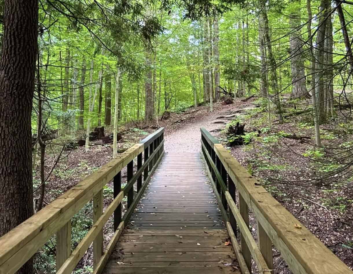
Starting at the Bridal Veil Falls Trailhead (AllTrails Page) on Gorge Parkway, this hike begins with a short descent via a boardwalk and steps to the Bridal Veil Falls.
This 20-foot waterfall cascades over layered shale, a 20-foot fall that spreads out over layered shale rock, hence the name, as it resembles a bride’s veil.
One mile in, you’ll arrive at the Tinker’s Creek Gorge Overlook, a designated National Natural Landmark.
From this vantage point, you can view the 220-foot-deep gorge (over the course of 2 miles) carved by Tinker’s Creek, the largest tributary of the Cuyahoga River.
A boardwalk and stairs lead down to a viewing platform, bringing you close enough to feel the cool mist. After admiring the falls (best after rains, when its multiple tiers are flowing), you’ll retrace your steps and then head into the woods along the Buckeye Trail.
The path winds through a serene forest of maple, oak, and hemlock, with Tinker’s Creek murmuring in the distance.
The signs at the viewpoint reveal how GLACIAL MELTWATER formed the gorge and note that you’re looking at one of Ohio’s most scenic river valleys.
This combo of waterfall and overlook is often cited among the best hiking trails in Cleveland for its one-two punch of natural wonders.
You can find more information on the official park map.
Practical details:
- Trail type: Out-and-back, ~2.0 mi (3.2 km) round trip. From Bridal Veil Falls trailhead to falls (0.1 mi), then ~1 mi each way on Buckeye Trail to the overlook and back.
- Difficulty: Easy to Moderate. The initial walk to Bridal Veil Falls is short and easy; the remainder is a dirt forest trail with mild elevation gain (only ~80 ft).
- Time needed: ~1 to 1.5 hours total.
- Trailhead: Bridal Veil Falls Trailhead on Gorge Parkway (Walton Hills, OH). Parking is along the road; no restrooms at the trailhead (the nearest facilities are at Bedford Reservation picnic areas).
- Dog-friendly? Yes, leashed dogs are allowed.
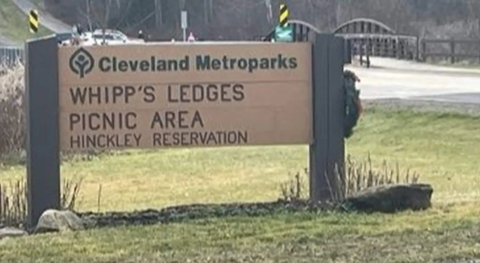
Whipp’s Ledges
For an awesome hike with a workout and great views, head to Whipp’s Ledges (AllTrails Page) in Hinckley Reservation.
Here you’ll find sandstone cliffs, some up to 30 feet high, rising from the forested hills.
These ledges were formed over 250 million years ago and reach elevations of 350 feet above Hinckley Lake, according to clevelandmetroparks.com.
The trail is a 1.2-mile loop that circles and ascends the ledges, offering a mini-adventure of rock scrambling and panoramic glimpses.
Starting from the Top O’ Ledges picnic area, follow the trail as it winds along the base of orange-brown cliff faces.
You can detour into narrow rock passageways, discover small caves, and even spot climbers roped up on popular routes (Whipp’s Ledges is a prime local rock-climbing spot).
The trail then climbs steeply, including some sections where you’ll be stepping up natural rock “stairs”, to reach the tops of the ledges.
The high ground also has a unique ecology: watch for chipmunks among the rocks and rare ferns clinging to cool, shaded cliff crevices.
Overall, Whipp’s Ledges deserves to be in our Cleveland hiking guide!
Practical details:
- Trail type: Loop, ~1.2 mi (2.0 km). Loop trail connecting Whipp’s Ledges Picnic Area and Top O’ Ledges, encircling the rock formations.
- Difficulty: Moderate – short but steep. Approximately 236 feet of elevation gain over a short distance, with rocky, uneven steps.
- Time needed: ~45 minutes to 1 hour. You may spend extra time climbing on rocks or enjoying views at the top.
- Trailhead: Whipp’s Ledges Picnic Area (State Road, between Bellus and Ledge Rd, Hinckley, OH). Parking, picnic tables, and pit toilets are available. The trail is well-marked from the lot.
- Dog-friendly? Yes, dogs on leash are allowed. However, be mindful of the steep rocky sections – agile dogs will do fine, but use a short leash near cliffs for safety.
Best times to hike in Cleveland
If you’re wondering when to plan your hiking in Cleveland, Ohio, look no further than autumn.
Why fall is Cleveland’s hiking sweet spot
Starting just after Labor Day, the air turns crisp, the skies stay bright, and traffic slows down.
It’s the ideal window to explore local routes before the first frosts settle in. Temperatures typically range from 50°F to 70°F (10°C to 21°C), which is perfect for hiking without overheating or layering excessively.
As the weeks progress, maples and oaks burst into color, painting Cleveland’s parks and nature preserves in glowing shades of yellow, orange, and deep red.
👉 INSIDER TIP: Aim for mid to late October if you want peak foliage color. Trails like the Brandywine Gorge Loop and Bedford Reservation are especially beautiful then. Arrive early to avoid parking delays, especially on weekends.

Unique hiking trails in Cleveland
While hiking in Cleveland is mostly known for its headline hiking trails like Brandywine Falls, the Ledges, and Whipp’s Ledges, there’s another layer of landscapes worth exploring.
These are the quieter corners of the Cleveland Metroparks, Lake Metroparks, and nearby natural areas, places where the experiences feel entirely your own.
Here you’ll find scenic overlooks no one’s talking about, hidden waterfalls, and stretches of forest or lakeshore where you might walk for an hour and see only wildlife.
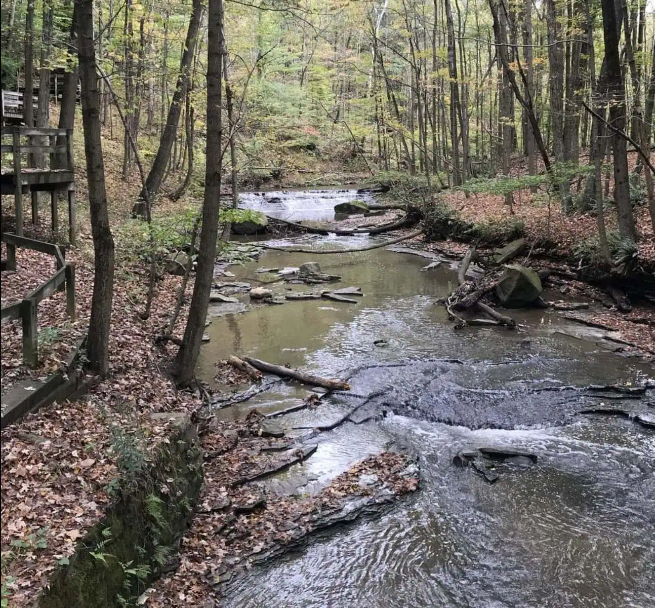
Euclid Creek Reservation
Euclid Creek Reservation (AllTrails Page) in the Cleveland Metroparks offers a mix of wooded hiking trails, rippling creek views, and a glimpse into Cleveland’s past.
The Euclid Creek Parkway winds through steep-walled valleys where sycamores arch overhead and water tumbles over small shale ledges.
Trails like the All Purpose Trail follow the creek for miles, linking picnic areas and quiet fishing spots. In autumn, the foliage reflects in the water for a postcard-worthy scene.
Chapin Forest Reservation
In the Lake Metroparks, Chapin Forest Reservation (AllTrails Page) delivers panoramic scenic overlooks of Lake Erie and, on clear days, the Cleveland skyline.
The Chapin Forest Reservation Trail winds through groves of white pine and maple, with side paths leading to exposed sandstone ridges.
In winter, the ridge trails offer long views through bare branches, and in summer, they’re shaded corridors alive with bird calls.
Penitentiary Glen Reservation
Penitentiary Glen Reservation (AllTrails Page) in the Lake Metroparks is known for its rugged hiking trails that explore deep ravines carved into the Ohio Shale.
The Gorge Rim Loop Trail skirts high above Penitentiary Glen, offering hidden scenic overlooks of rocky outcrops and seasonal waterfalls.
Spring brings a burst of wildflowers along the Cherry Lane Trail, while fall transforms the ravine into a tapestry of reds and golds.
Hell Hollow Wilderness Area
For those craving solitude, Hell Hollow Wilderness (AllTrails Page) in the Lake Metroparks feels worlds away from the city.
Trails lead through a mix of upland forest and steep descents into a shale gorge carved by Paine Creek.
The Gorge Rim Loop offers several quiet viewpoints, and in spring, the forest floor is blanketed with trillium.
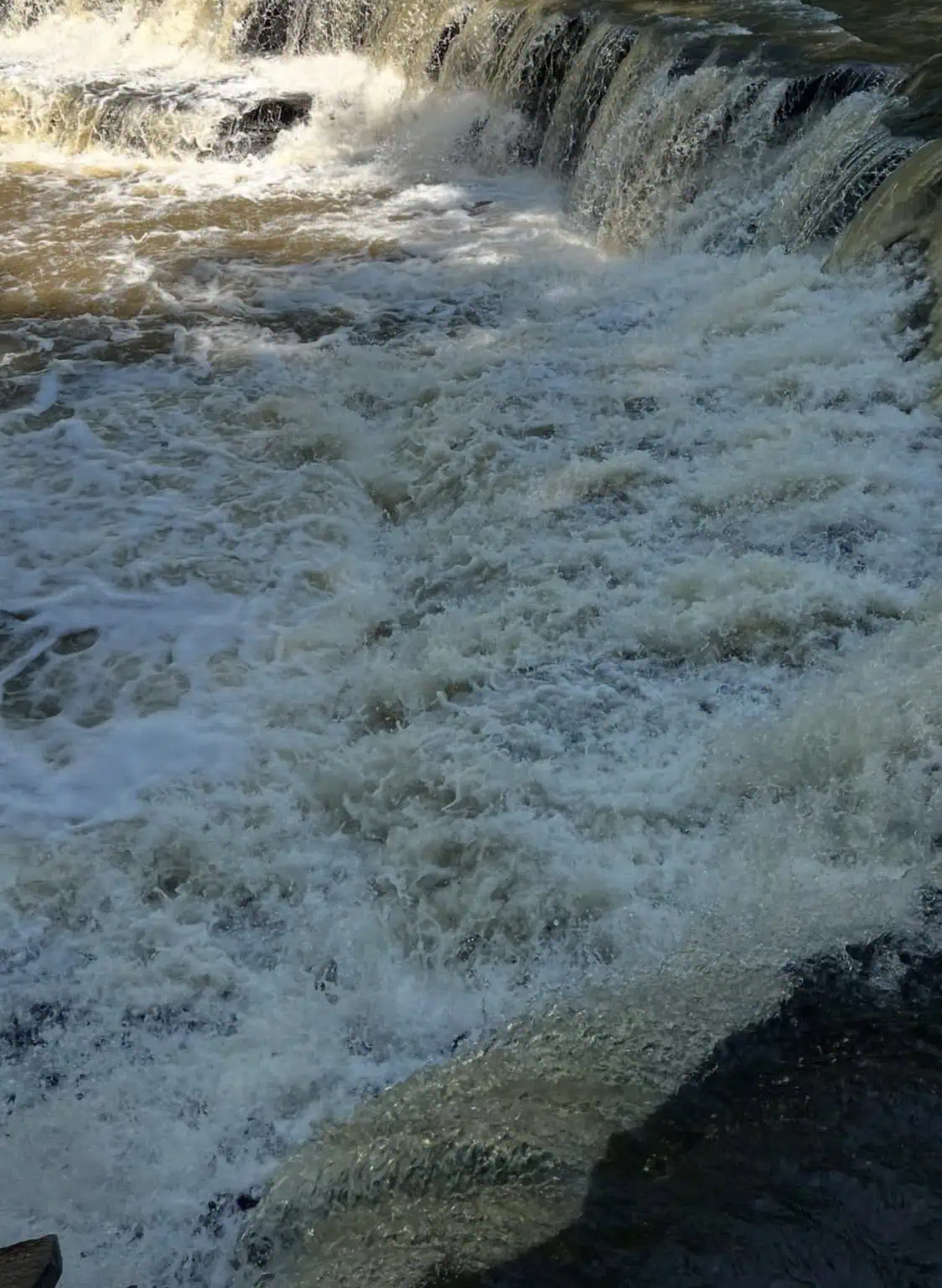
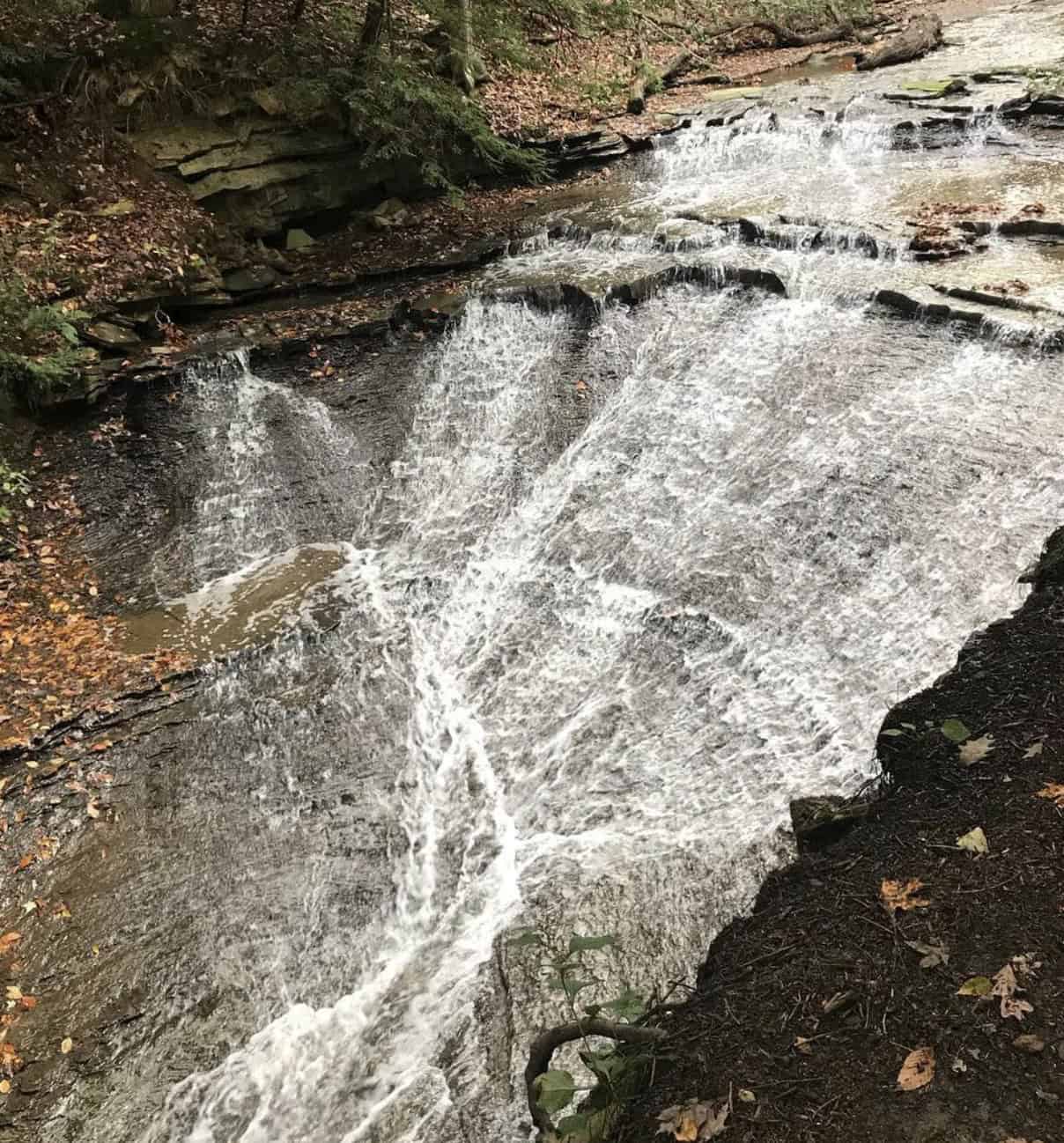
Mill Creek Falls
Mill Creek Falls (AllTrails Page), the tallest waterfall in Cuyahoga County at 48 feet, is tucked into Cleveland’s Old Brooklyn neighborhood.
Accessible via the All Purpose Trail, it cascades over a dramatic wall of Cleveland Shale.
The viewing deck offers a front-row seat to the roaring water in spring and a frozen cascade in winter.
Fairport Harbor Lakefront Park
On the edge of Lake Erie, this Lake Metroparks gem pairs sandy beaches with paved and natural trails.
Walk the shoreline for endless lake views, then climb to the park’s observation points for sweeping panoramas.
Summer sunsets here rival any in the region, with the lighthouse standing guard in the distance.
Written by Laura and Alexander, an experienced travel couple specializing in hiking guides across the U.S., with personal experience on over 50 Cleveland-area trails!
FAQ
What is the number one hiking trail in Ohio?
The Whispering Cave Trail at Hocking Hills State Park is often cited as Ohio’s top hiking trail. This five-mile loop gently winds through quiet forests, over a swinging bridge, and into the hush of a large cave behind a seasonal waterfall, showcasing the kind of natural magic Ohio’s trails have to offer. In fact, it was voted the best hiking trail in the entire country in a 2024 national poll, underscoring its popularity and beauty.
Where to hike in Cleveland, Ohio?
Cleveland offers plenty of places to hike, both in the city and nearby. The Cleveland Metroparks system covers over 25,000 acres and contains hundreds of miles of trails through forests, riverside paths, and even waterfalls around the city. Local favorites include the loop to Buttermilk Falls in North Chagrin Reservation or the Fort Hill stairs in Rocky River Reservation, among many others. Just south of Cleveland, Cuyahoga Valley National Park provides even more scenic hikes – trails like the Brandywine Gorge or Ledges Trail lead to breathtaking waterfalls and sandstone ledges, giving hikers a peaceful nature escape without venturing far from the city.
Is Cleveland good for hiking?
Yes. Hiking in Cleveland, often to the surprise of newcomers. Nicknamed “The Forest City” for its abundance of green space, the area is surrounded by an extensive Metroparks “Emerald Necklace” that offers hundreds of miles of peaceful trails through woodlands, river gorges, and even waterfalls. These parks – along with the easily accessible Cuyahoga Valley National Park just outside the city – mean that hiking enthusiasts don’t have to travel far to find scenic views and tranquil nature paths around Cleveland.
Is there a riverwalk in Cleveland?
Yes, Cleveland does have a sort of riverwalk. In the Flats East Bank district downtown, a 1,200-foot riverfront boardwalk stretches along the Cuyahoga River. This linear park by the water is lined with railings, seating areas, and nearby restaurants, offering a scenic place to stroll beside the gentle river and take in views of the city’s waterfront. The riverwalk provides locals and visitors with a calm, leisurely way to experience Cleveland’s riverside atmosphere.