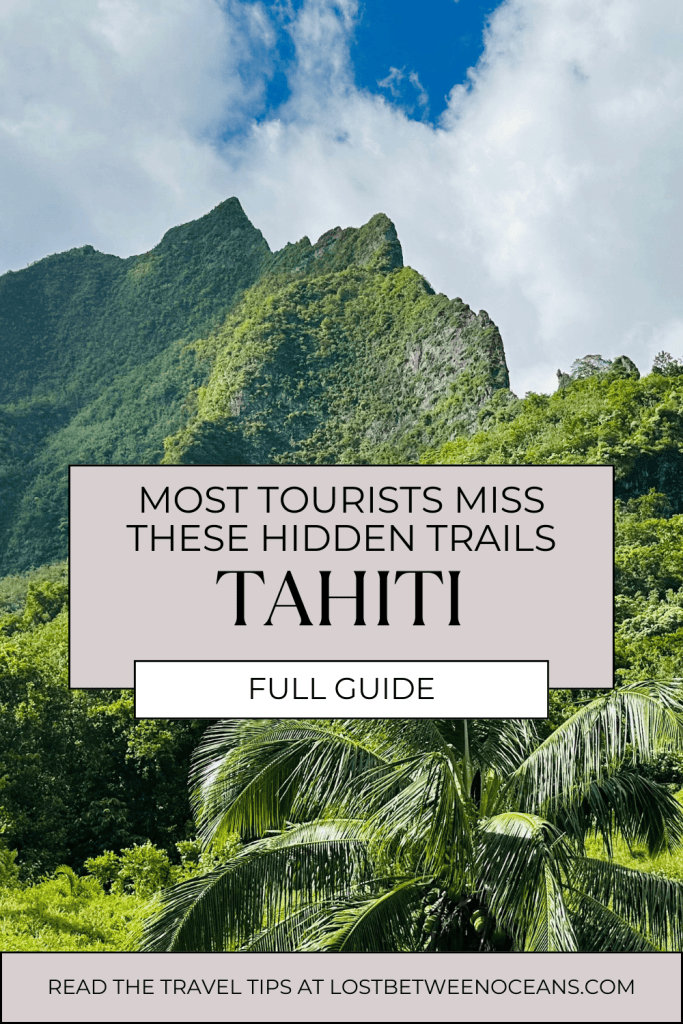
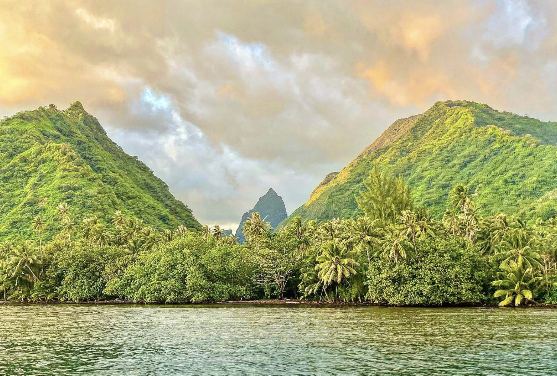
Welcome to the full guide to hiking in Tahiti!
What are the best hikes in Tahiti? What should you know about them, and where can I download the navigational map?
Discover it here!
KEY TAKEAWAYS:
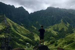
- 🌄 Tahiti’s highest peaks, Mount Orohena (2,241m / 7,352ft) and Mount Aorai (2,066m / 6,778ft) offer some of the most challenging and rewarding hikes in Tahiti.
- 🔄 Loop trails: Vaipahi Great Loop, Heights of Vaiatu Paea, and Apostles Trail provide scenic and well-marked circular routes.
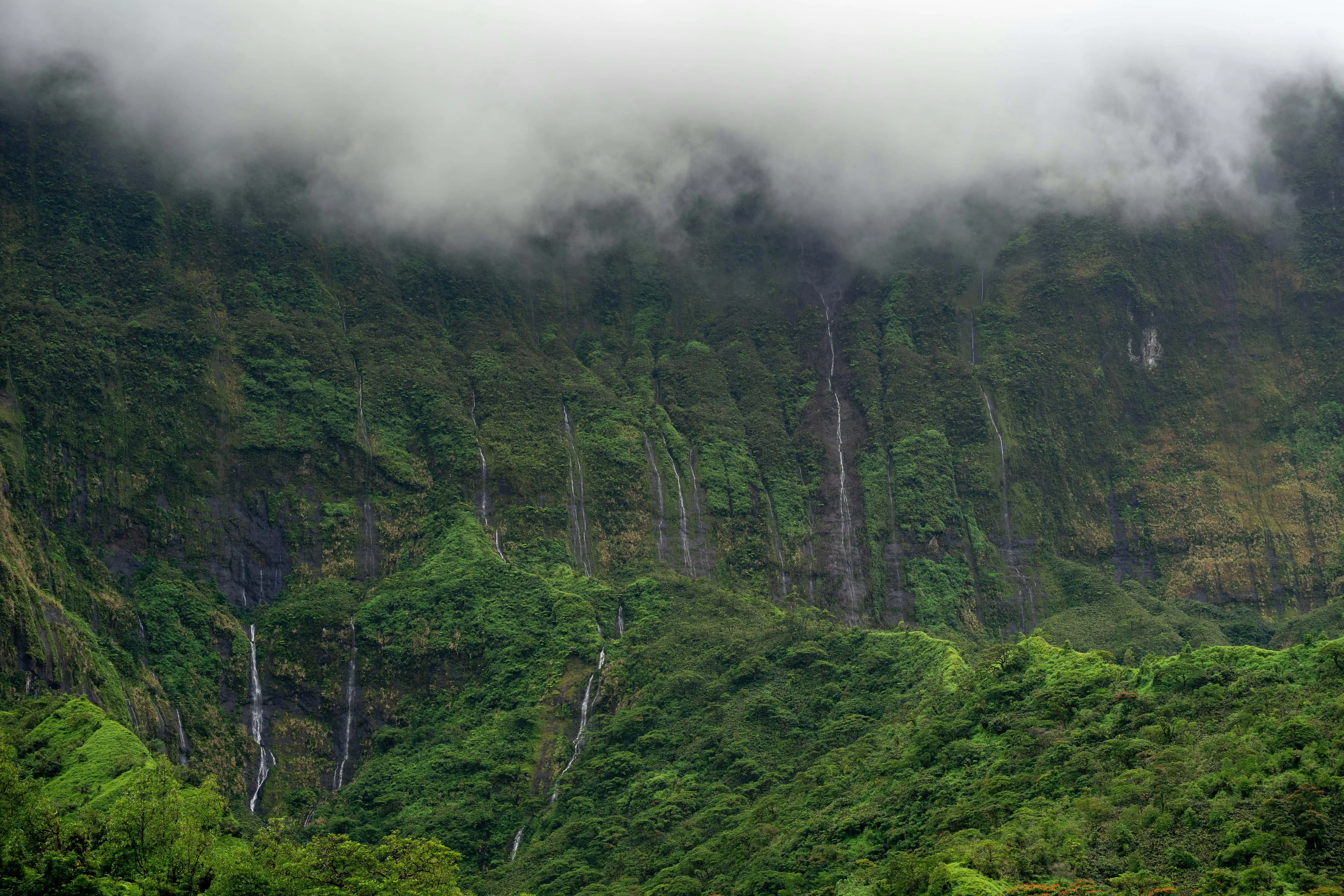
- 🌿 Tahiti’s nature: From lush rainforests and volcanic peaks to waterfalls and coastal cliffs, hiking in Tahiti allows you to experience the island’s untouched landscapes.
Dreaming of a French Polynesian vacation?
Fill in our SHORT FORM, and we will match you with trusted local tour operators who can build a personalized itinerary based on your STYLE, BUDGET, and TRAVEL DATES.
Our local partners create every itinerary with care. We kindly ask that you submit a request only if you’re considering traveling.
Does Tahiti have good hiking?
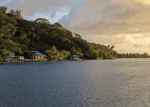
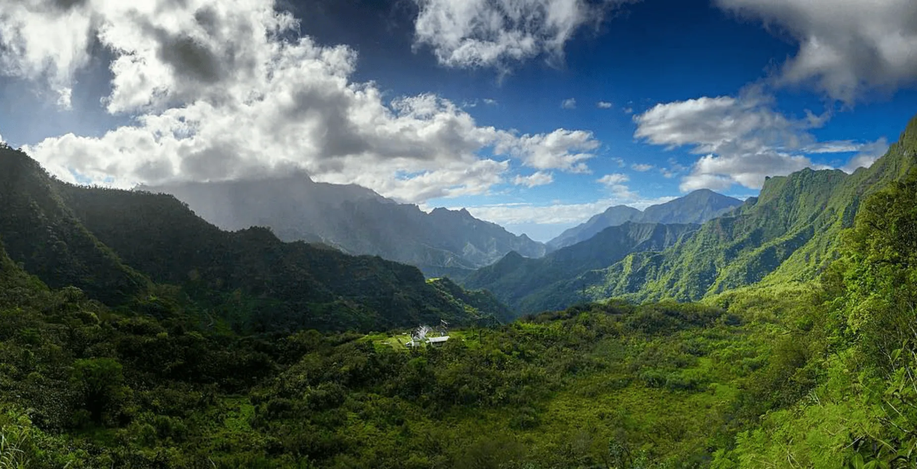
Yes, Tahiti offers some of the best hiking in the South Pacific, with lush valleys (like Papenoo Valley), seven amazing waterfalls, and volcanic peaks.
The island’s rugged interior is covered in rainforests, deep river gorges, and high-altitude ridges, making it an adventure-lover’s paradise.
Best time for hiking in Tahiti
During the dry season, the best time hiking in Tahiti is between May and October.
This period offers more stable weather and drier trails, reducing the risk of slipping.
For a full, rewarding experience of the incredible views, start your hike around 5:00 a.m. so you reach the summit before the clouds that turn up around 10 am, blocking the breathtaking panoramas.
Emergency Contacts when hiking in Tahiti
In case of an emergency while hiking in Tahiti, call 17 for police assistance and 15 for medical help.
Top 13 trails for hiking in Tahiti
Below, you can find our hiking guide, showing all Tahiti hiking trails one by one, with a LINK to download their map.
Overview:
| 🌄 Summit Hikes | 🔄 Loop Trails | 🌿 Scenic & Nature Trails |
| Mount Orohena – Highest peak in Tahiti | Vaipahi Great Loop – Waterfalls & gardens | Te Pari – Coastal cliffs & lagoons |
| Mount Aorai – Ridgeline challenge | Heights of Vaiatu Paea – Gradual forest incline | Fautaua Waterfall – Rainforest & ancient ruins |
| Papaiona – Green Peak – Fast summit hike | Apostles Trail – Shaded jungle path | Vaihi & 7 Waterfalls – Hidden jungle waterfalls |
| Mont Marau – Gradual climb with views | Mahinarama Trail – Long but steady trek | Marae Arahurahu Trail – Cultural & nature walk |
| Atiue (Plateau Vaitavere) – Open ridge views |
Simply fill in the form below to get a FREE QUOTE from trusted local travel specialists who know the islands inside out.
It only takes 60 seconds, and you’ll receive custom itineraries and pricing directly in your inbox or WhatsApp within
48 hours.
Free of charge. No pressure. No obligation.
*Our trusted local partners create every itinerary with care. We kindly ask that you submit a request only if you’re considering traveling.
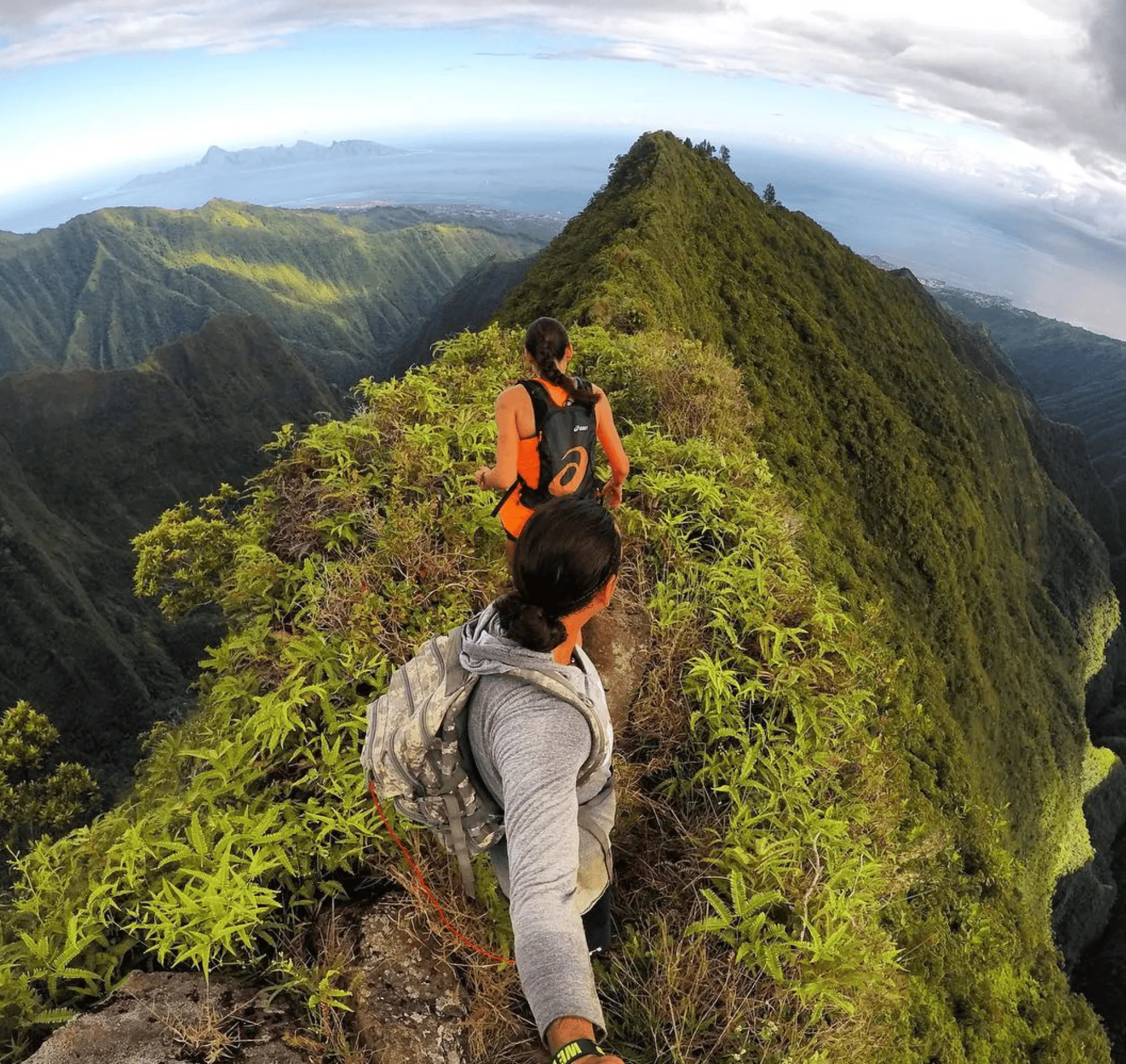
Mount Aorai Hike
- Length: 12.2 km (7.6 miles) out-and-back
- Summit: 2,066 meters (6,778 feet)
- Time to complete: 10 hours
- Difficulty: Challenging – Steep inclines, ridgeline sections, and some scrambling
- Permit required? No
- Trailhead: Pirae commune, near O Belvedere restaurant
- AllTrails link: Mount Aorai Trail
This popular trail to Mount Aorai starts in Pirae, near O Belvédère restaurant.
The first section is shaded and relatively easy, winding through the rainforest filled with Tahitian chestnuts and Tiare flowers.
The path gradually steepens, revealing glimpses of deep valleys and peaks as the vegetation thins.
As you gain altitude, the trail becomes steeper and more exposed, following a narrow ridgeline with drop-offs. Some sections require scrambling, and ropes are available to assist.
The reward? Breathtaking views of Tahiti’s mountains, the coastline, and the Pacific Ocean stretch into the horizon.
The descent is just as demanding, especially along the exposed sections where footing is crucial.
Mont Marau Hike
- Length: 9 km (5.6 miles) out-and-back
- Time to complete: 3 hours to the summit
- Difficulty: Easy to Moderate – Gradual ascent, rocky terrain, and little shade
- Summit elevation: 1,400 meters (4,593 feet)
- Permit required? No
- Trailhead: Near Lotissement Miri, Puna’auia (West Tahiti)
- AllTrails link: Mont Marau Trail

Located in West Tahiti, Mont Marau offers a gradual ascent to 1,400 meters (4,593 feet), making it a great choice for an easy but scenic hiking in Tahiti experience.
The trailhead is near Lotissement Miri in Puna’auia, with ample parking nearby. The most commonly used 4×4 trail is wide, rocky, and relatively flat, though exposed to the sun, so bring sun protection and lots of water (in a water bottle, we recommend 2 liters of water per person).
The hike is steady and not too steep. However, if the weather is cloudy, visibility at the top may be limited, taking away the stunning views that make this hike worthwhile.
On a clear day, you’ll see breathtaking panoramas of Tahiti’s landscapes, including Mount Aorai in the distance.

Mount Orohena Hike
- Length: 14–19 km (9–12 miles) out-and-back
- Time to complete: 6+ hours to the summit
- Difficulty: Very Challenging – Steep ascents, ridgeline hiking, and technical terrain
- Summit elevation: 2,241 meters (7,352 feet) – HIGHEST peak in French Polynesia
- Permit required? No
- Trailhead: Mahina commune, near Papeete
Mount Orohena is the highest peak in French Polynesia, at 2,241 meters (7,352 feet).
This technical hike begins in Mahina, north of Papeete, and is not for beginners but only for experienced hikers. The first section involves uphill climbing through dense, overgrown terrain, with some areas requiring scrambling.
As you gain elevation, the trail follows a ridge with sharp drop-offs on both sides, making balance and careful footing crucial (we recommend sturdy hiking boots).
You’ll pass Pihaiateta (1,742m) and Pito Iti (2,110m), popular camping spots for multi-day hikers. From Pito Iti, the final push to Orohena’s summit is the most challenging, with steep, exposed ridges and limited footholds.
Reaching the highest point in Tahiti is a true achievement. You’ll get unmatched 360-degree epic views of Tahiti’s mountains, valleys, and the vast Pacific Ocean from the summit.
Definitely a must-do on your hiking in Tahiti list!
Mahinarama Trail
- Length: 11.5 km (7.2 miles) out-and-back
- Time to complete: 5 hours
- Difficulty: Moderate – Long but well-defined trail with shaded sections
- Summit elevation: 457 meters (1,500 feet)
- Permit required? No
- Trailhead: Near Super Marché Mahina, north Tahiti
- AllTrails link: Mahinarama Trail

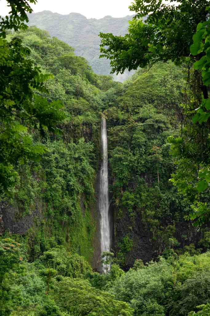
Cascade de Loti (Fautaua Waterfall) Hike
- Length: 5.8 km (3.6 miles) out-and-back
- Time to complete: 2–3 hours to the beautiful waterfall
- Difficulty: Moderate – Some muddy sections and river crossings
- Summit elevation: Fautaua Waterfall stands at 360 meters (1,181 feet)
- Permit required? Yes, $5 USD (€4.60) from Mairie de Papeete
- Trailhead: Fautaua Valley parking lot, near Papeete
- AllTrails link: Fautaua Waterfall Trail

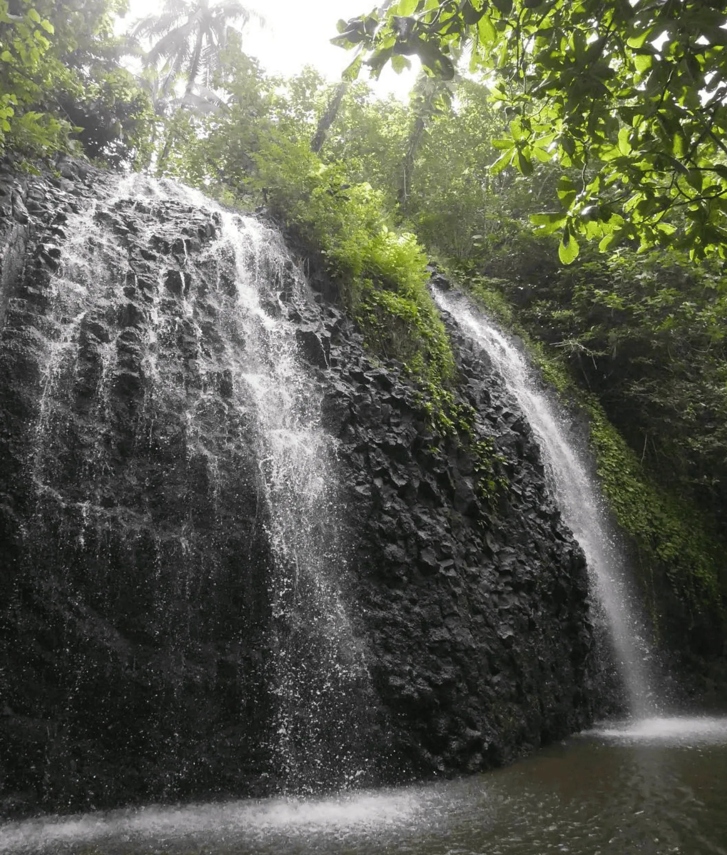
This jungle trek in Fautaua Valley takes you through dense rainforests, ancient stone temples, and cascading streams, leading to one of Tahiti’s most famous waterfalls.
The trail starts from the Fautaua Valley parking lot, where you’ll need to show a permit from Mairie de Papeete (€4.60 / $5).
The first 2.5 km (1.5 miles) of the trail is flat and wide, making for an easy warm-up before the real climb begins.
At the bridge, you have two route options: the upper trail, which is longer but easier, or the lower trail, which is steeper, muddier and includes river crossings.
Both paths wind through lush vegetation, but the lower route can be slippery after rain, especially in the wet season. Be prepared for mosquitoes and dense foliage, and download a GPS map since the trail markings are limited.
After about 2–3 hours, you’ll reach Fautaua Waterfall, a 360-meter (1,181-foot) cascade. The powerful rush of water, surrounded by towering cliffs and tropical greenery, creates a truly magical setting.
At the base, you’ll find a POOL with plenty of water for a refreshing swim.
Simply fill in the form below to get a FREE QUOTE from trusted local travel specialists who know the islands inside out.
It only takes 60 seconds, and you’ll receive custom itineraries and pricing directly in your inbox or WhatsApp within
48 hours.
Free of charge. No pressure. No obligation.
*Our trusted local partners create every itinerary with care. We kindly ask that you submit a request only if you’re considering traveling.
Te Pari Trail
- Length: 10 km (6.2 miles) loop
- Time to complete: 4–6 hours
- Difficulty: Moderate to Challenging – Rough, rocky terrain with steep climbs
- Summit elevation: 112 meters (367 feet)
- Permit required? No
- Trailhead: Te Pari Cliffs, southeast Tahiti Iti, near Teahupoo
- How to get there: By boat or via Fenua Aihere hike (adds 2–3 hours)
Located in southeast Tahiti Iti, the Te Pari Trail is one of the most adventurous hikes on the island, with a mix of jungle terrain, steep cliffs, and coastal views.
The trail begins in a lush valley, winding through dense tropical forests before gradually ascending to panoramic viewpoints over the turquoise lagoon.
The rocky path can be challenging, especially if wet, but ropes are available to assist in steep sections.
Along the way, you’ll pass hidden waterfalls, dramatic cliffs, and scenic beaches, making this one of the most diverse hiking in Tahiti opportunities. If you’re feeling daring, some cliffs even offer safe spots to jump into the clear waters below.
To access Te Pari, you can either take a boat or trek via the Fenua Aihere hike, which adds an additional 2–3 hours to your journey. Given the remote location and rugged terrain, many opt for a guided tour or boat ride to fully enjoy the untouched beauty of Tahiti Iti.
Vaipahi Great Loop to River
- Length: 4.8 km (3 miles) loop
- Time to complete: Less than 2 hours
- Difficulty: Easy to Moderate – Some steep sections and a river crossing
- Summit elevation: N/A – Trail features gradual inclines
- Permit required? No
- Trailhead: Vaipahi Water Gardens, South Tahiti
- AllTrails link: Vaipahi Great Loop Trail
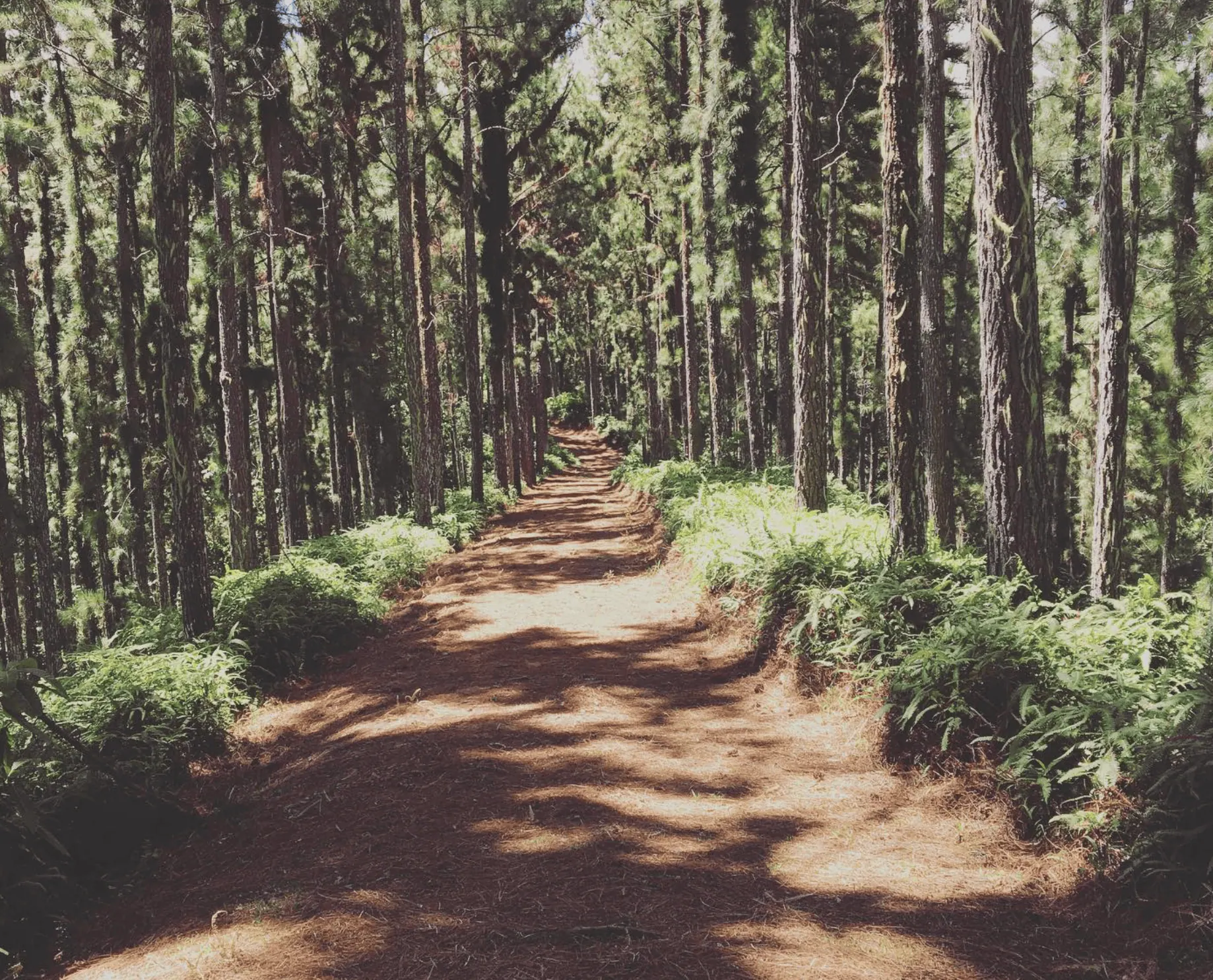
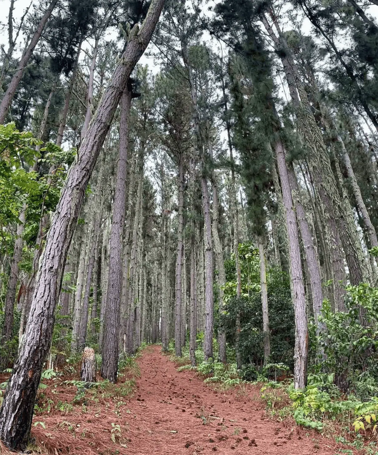
Starting at the Vaipahi Water Gardens, this scenic loop trail takes you through pine forests (so bring bug spray), waterfalls, and panoramic viewpoints.
A map at the entrance clearly marks the routes, ensuring an easy-to-follow path. The first section begins with a gentle uphill climb before leading into a wide, well-maintained trail perfect for both hiking and running.
At the loop junction, you can choose between two paths: the west loop, which offers a longer climb and better views, or the east loop, which connects to the river trail.
The river trail features steep and slippery sections, a river crossing, and ropes for support in certain areas, which makes it slightly more challenging but also more adventurous.
Apostles Trail (Mission Hike)
- Length: 8 km (5 miles) loop
- Time to complete: 3 hours
- Difficulty: Moderate – Mostly dry paths with some slippery sections
- Summit elevation: N/A – The trail stays within the dense lush rainforest
- Permit required? No
- Trailhead: End of Pureora Street, Papeete
- AllTrails link: Apostles Trail (Mission Hike)

This lush, dense forest hike offers a quick escape from the city. It starts at the end of Pureora Street in Papeete.
Look for the metal chain marking the trailhead, and you’re on your way. The first section is shaded and dry, gradually descending into the jungle.
The trail splits into two routes: the left path is shorter but slippery, while the right path is drier but one mile longer. Both wind through dense tropical vegetation, with ferns and tangled roots lining the way.
If it has rained recently, expect thick mud, and wear proper hiking shoes for grip.
At the end, the views open up, revealing Tahiti’s green valleys and rolling mountains. For an even better panorama, hike slightly further uphill before heading back. The loop reconnects near the end, making for a smooth return journey.
Marae Arahurahu Trail
- Length: 3 km (1.9 miles) out-and-back
- Time to complete: 1 hour
- Difficulty: Easy – Rocky terrain, river crossing, and minimal elevation gain
- Summit elevation: 160 meters (525 feet)
- Permit required? No
- Trailhead: Marae Arahurahu, Paea district (West Tahiti)
- AllTrails link: Marae Arahurahu Trail

The Marae Arahurahu Trail deserves a special spot on the list of the best trails for hiking in Tahiti!
Near Rohto Beach in the Paea district, Marae Arahurahu is a sacred Polynesian site with deep cultural significance.
Behind the archaeological ruins, you’ll find a HIDDEN JUNGLE TRAIL, offering a short and easy hike through lush forest and rocky terrain.
The path is not well-marked, so a GPS map is essential to avoid getting lost. The first section is shaded by dense tree canopies, keeping temperatures comfortable.
Midway through, you’ll encounter a river crossing, which may be slippery after rain. The trail ends at a barricade, requiring a return journey along the same route.
Though the hike lacks summit views, it’s a peaceful and secluded nature walk.
Simply fill in the form below to get a FREE QUOTE from trusted local travel specialists who know the islands inside out.
It only takes 60 seconds, and you’ll receive custom itineraries and pricing directly in your inbox or WhatsApp within
48 hours.
Free of charge. No pressure. No obligation.
*Our trusted local partners create every itinerary with care. We kindly ask that you submit a request only if you’re considering traveling.
Papaiona – Green Peak Hike
- Length: 7.5 km (4.7 miles) out-and-back
- Time to complete: Less than 2 hours to the summit
- Difficulty: Moderate – Steep sections, slippery spots, and overgrown trails
- Summit elevation: 1,100 meters (3,609 feet)
- Permit required? No
- Trailhead: Mamaias housing estate (Les Mamaias) in Faa’a
- AllTrails link: Papaiona – Green Peak Trail

This is one of the best Tahiti hiking you can do, just a short distance away from Papeete, leading to the 1,100-meter-high summit of Green Peak in just under two hours.
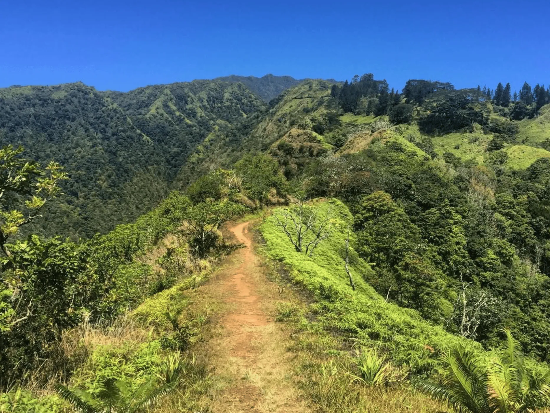
The trail begins at the Mamaias housing estate in Faa’a, where you’ll enter a forest path with well-defined trails and gentle inclines.
The first half of the hike is relatively easy, with plenty of shade and lush vegetation.
As you climb higher, in some sections, the path is overgrown, and ferns with sharp edges can scratch your skin, so wear long sleeves and pants.
At the summit, you’ll be rewarded with panoramic views of Papeete, the coastline, and the peaks of Moorea in the distance.
The descent follows the same route, and while the wide path becomes easier, watch out for slippery spots.
This short but scenic hiking in Tahiti trail is a great way to experience Tahiti’s beauty without a full-day commitment.
Heights of Vaiatu Paea
- Length: 9 km (5.6 miles) out-and-back
- Time to complete: 3 hours
- Difficulty: Moderate – Steep start, gradual incline, and overgrown sections
- Summit elevation: 650 meters (2,133 feet)
- Permit required? No
- Trailhead: Near Public Elementary School Vaiatu, Paea (West Tahiti)
- AllTrails link: Heights of Vaiatu Paea Trail
Atiue (Plateau Vaitavere) Hike
- Length: 12.8 km (8 miles) out-and-back
- Time to complete: 2.5 hours to the summit
- Difficulty: Moderate – Steep sections, overgrown foliage, and little shade
- Summit elevation: 1,084 meters (3,556 feet)
- Permit required? No
- Trailhead: Puna’auia, near Primary School Manotahi or Vaitavere Cemetery
- AllTrails link: Atiue (Plateau Vaitavere) Trail
Vaihi and 7 Waterfalls Hike (Vaihi de Hitia’a)
- Length: 6.3 km (3.9 miles) out-and-back
- Time to complete: 2+ hours to the final waterfall
- Difficulty: Moderate – Rough, unmarked paths, stream crossings, and exposed sections near the end
- Summit elevation: N/A – Final viewpoint offers superb views
- Permit required? No, but a guide is recommended
- Trailhead: Vaihi Waterfalls, Hitia’a, East Tahiti
This hike is part of the seven best Tahiti waterfalls!
Simply fill in the form below to get a FREE QUOTE from trusted local travel specialists who know the islands inside out.
It only takes 60 seconds, and you’ll receive custom itineraries and pricing directly in your inbox or WhatsApp within
48 hours.
Free of charge. No pressure. No obligation.
*Our trusted local partners create every itinerary with care. We kindly ask that you submit a request only if you’re considering traveling.
FAQs about hiking in Tahiti
What’s the most difficult hike in Tahiti?
The two most challenging hikes on the island are Mount Orohena (2,241m) and Mount Aorai (2,066m). Both feature steep ascents, exposed ridges, and long distances, requiring technical skill levels, endurance, and proper preparation.
What’s the easiest hike in Tahiti?
For beginners, the Vaipahi Great Loop and Heights of Vaiatu Paea are excellent choices. These flat and wide trails offer gradual inclines, well-maintained paths, and scenic viewpoints, making them accessible and enjoyable for all levels.
Which hike has the most elevation gain in Tahiti?
The Mount Orohena hike has the greatest elevation gain, reaching an impressive 2,241 meters (7,352 feet)—the highest peak in French Polynesia.
Are there any running trails in Tahiti?
Yes, the Vaipahi Great Loop and Heights of Vaiatu Paea are ideal for trail running. Their flat and wide tracks provide stable footing, while the scenic landscapes make for a rewarding workout.
Are there dog-friendly hikes in Tahiti?
Yes! Several dog-friendly trails include: Apostles Trail (Mission Hike), Mahinarama Trail, Heights of Vaiatu Paea and Vaipahi Great Loop to River These trails offer safe terrain for dogs, though some require leashes depending on the area. Always bring water for your pet and be mindful of the heat and trail conditions.