
Welcome to the guide about all Moorea hiking trails.
Discover the 10 best Moorea hiking trails, their features, and links to access them on a map.
Let’s get started.
KEY TAKEAWAYS:
- Summiting Moorea’s toughest peaks, Mount Rotui and Mount Mou’aputa, are though hikes with exposed ridges and rope-assisted climbs.
- Lookouts with the best viewpoints: Belvedere Lookout and Toatea Lookout offer panoramic views of Moorea’s mountains, bays, and lagoon.
- Waterfall hikes for all levels: Afareaitu Waterfalls is a short, rewarding jungle hike leading to two stunning waterfalls with pools.
Dreaming of a French Polynesian vacation?
Fill in our SHORT FORM, and we will match you with trusted local tour operators who can build a personalized itinerary based on your STYLE, BUDGET, and TRAVEL DATES.
Our local partners create every itinerary with care. We kindly ask that you submit a request only if you’re considering traveling.
Overview of top 10 Moorea hiking trails
|
Trail Name |
Description |
|
| Three Coconuts Trail (Col des Trois Cocotiers) | A moderate jungle hike leading to a spectacular ridge viewpoint over Opunohu Valley and Mount Rotui. | |
| Three Pines Trail (Col des Trois Pinus) | A secluded alternative to Three Coconuts Trail, offering lush forest paths and a scenic lookout. | |
| Afareaitu Waterfalls | A short rainforest hike featuring two stunning waterfalls with swimmable pools and river crossings. | |
| Mount Rotui | One of Moorea’s toughest hikes, featuring steep ridgelines and exposed cliffs, with unbeatable summit views. | |
| Mount Mou’aputa (Pierced Mountain) | A legendary hike requiring scrambling and ropes, leading to a pierced summit rock with panoramic island views. | |
| Vai’are to Paopao | A scenic cross-island trek through dense jungle and mountain ridges, connecting Vai’are village to Paopao Valley. | |
| Mount Paaru Iti (Paaruiti) | A challenging, less-traveled hike with steep inclines and overgrown paths, leading to coastal and mountain views. | |
| Vaiare Pass (Col de Vai’are) | A moderate hike connecting Opunohu Valley to Vai’are, passing ancient marae and bamboo groves. | |
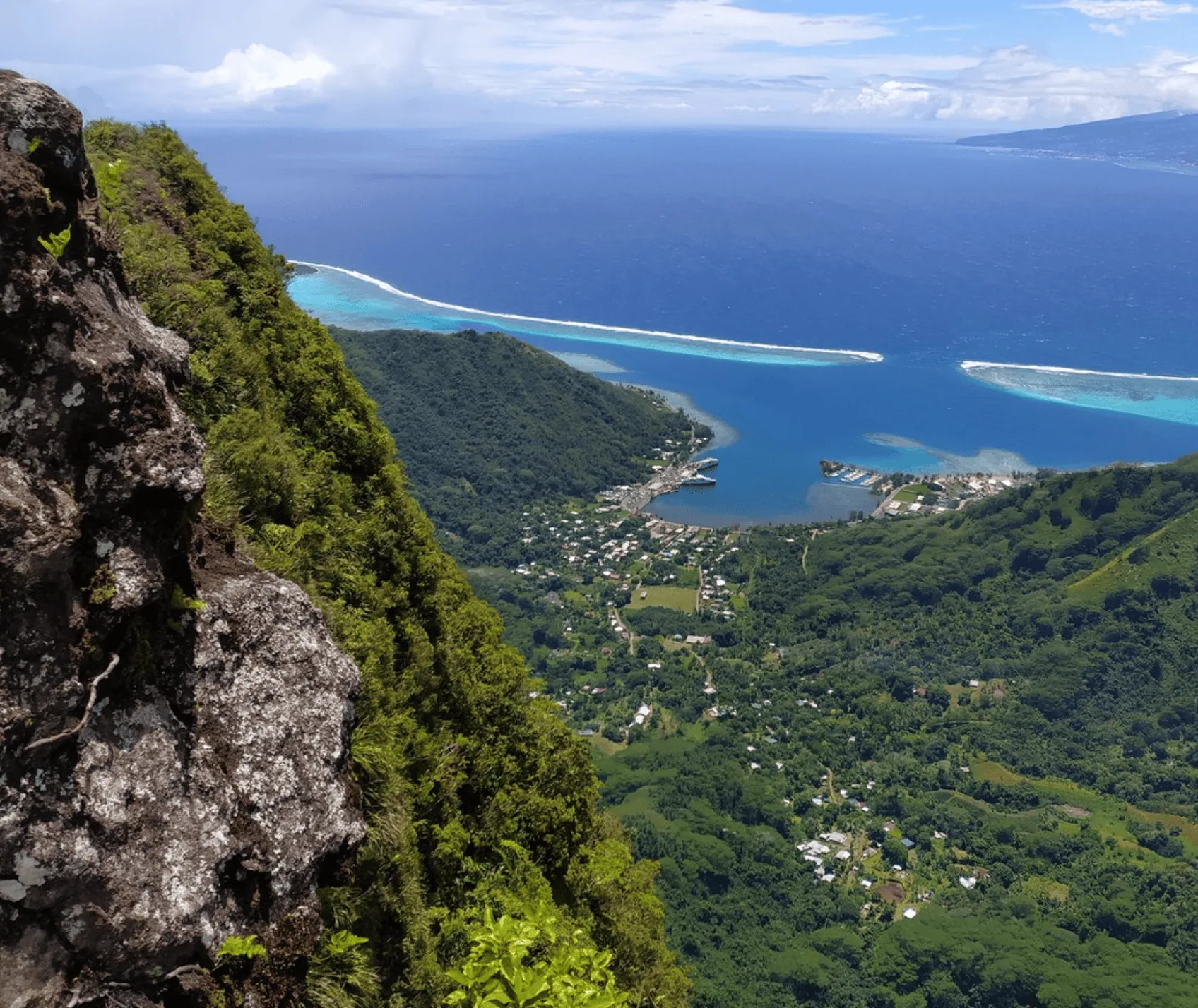
| Belvedere Lookout | A famous, easily accessible viewpoint offering 360-degree views of Cook’s Bay, Opunohu Bay, and Mount Rotui. | |
| Toatea Lookout | A quick roadside stop with stunning views of Moorea’s lagoon, Sofitel’s overwater bungalows, and Tahiti in the distance. |
Belvedere Lookout
- Elevation: 240 meters (787 feet)
- Time to reach by car: 15–20 minutes from most resorts
- Hiking options: Accessible by car, bike, or on foot via the Three Coconuts Trail
- Permit required? No
- Location: Opunohu Valley, Moorea
- Google Maps link: Belvedere Lookout on Tripadvisor
Belvedere Lookout is Moorea’s most famous viewpoint, offering panoramic views over Opunohu Bay, Cook’s Bay, and Mount Rotui.
Situated at 240 meters (787 feet) above sea level, it’s easily accessible by car, bicycle, or even from hiking.
From here, you’ll get a stunning 360-degree perspective of the island’s dramatic landscape, lush valleys, and the twin bays that give Moorea its heart-shaped appearance.
The lookout is located in Opunohu Valley, about 20 minutes by car from the ferry terminal in Vaiare.

A paved road leads all the way up, making it one of the few scenic viewpoints in Moorea that doesn’t require a hike.
If you don’t have a rental car, you can reach the viewpoint by:
- Bike – Rent an e-bike for an easier climb (around 2,500 XPF / €21 / $23 per day).
- ATV or 4WD tour – Available through local operators.
- Hiking – The Three Coconuts Trail begins at the lookout and takes about 2.5–3 hours round trip.
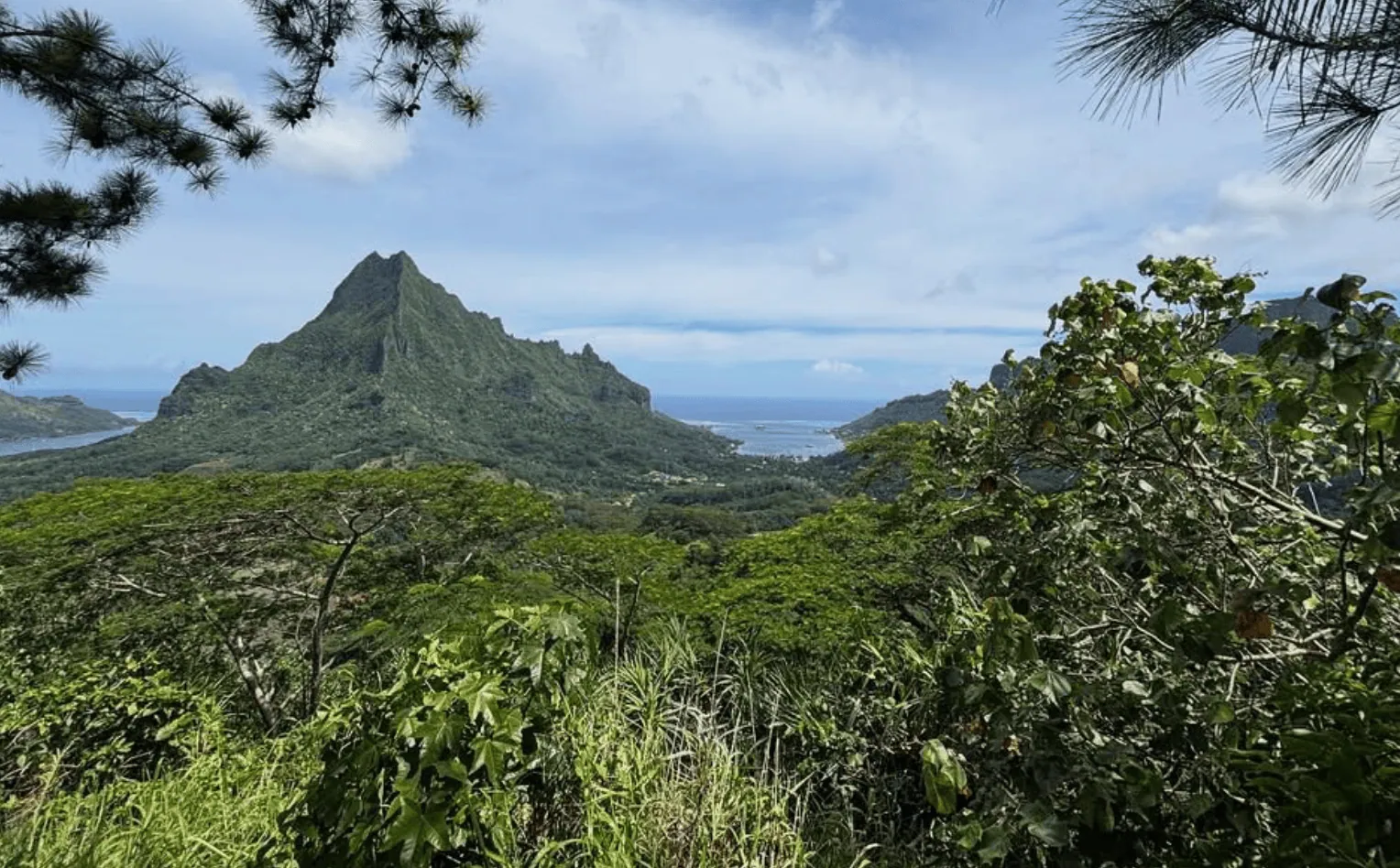
Three Coconuts Trail (Col des Trois Cocotiers)
- Length: 6.9 km (4.3 miles) out-and-back
- Summit: 260 meters (853 feet)
- Time to complete: 2.5–3 hours
- Difficulty: Moderate – Steady inclines, muddy sections after rain, and exposed ridgeline
- Permit required? No
- Trailhead: Belvedere Lookout, near Opunohu Valley
- AllTrails link: Three Coconuts Trail
This is one of Moorea’s most popular hikes, offering a mix of jungle Moorea hiking trails, mountain views, and a lookout point over Opunohu Valley.
The trail begins at Belvedere Lookout, one of the island’s most famous viewpoints, and leads you into a dense tropical forest filled with ferns, banyan trees, and palms.
The path is mostly shaded, making it comfortable even in the midday heat, but mosquitoes can be relentless, so taking repellent with you is a must.
The first section of the hike is fairly easy, following a wide dirt track before gradually narrowing into a steeper climb.
You’ll pass massive tree roots, cross a small stream, and make your way up through sections of thick bushes.
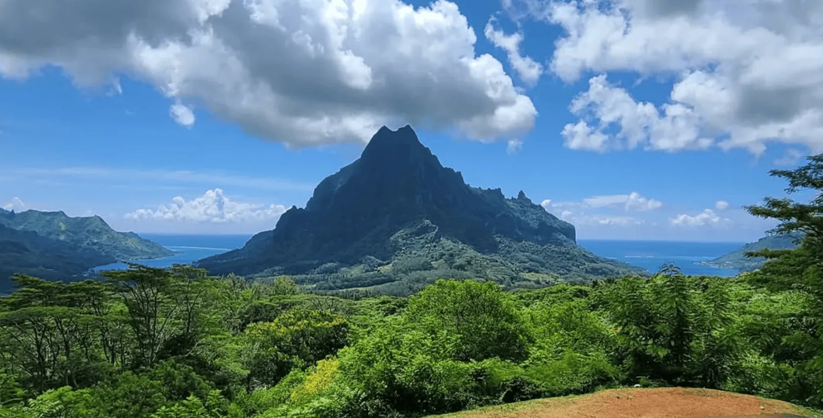
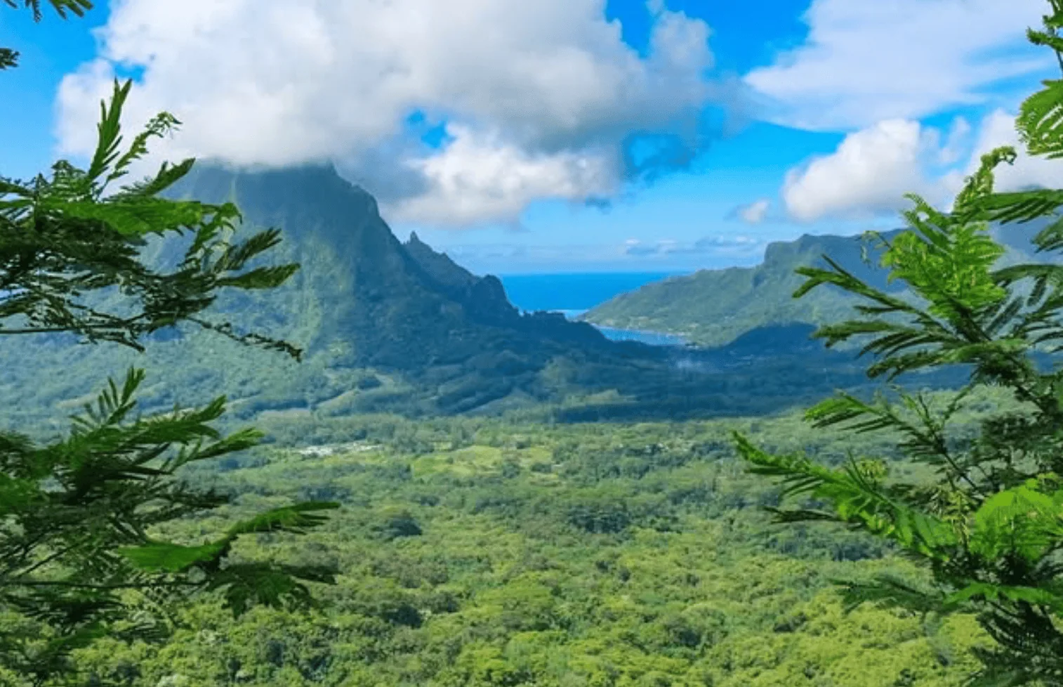
The final ascent to the Three Coconuts Pass is steeper and more exposed, offering incredible views of Mount Rotui, Opunohu Bay, and the Pacific Ocean beyond.
If you time it right, the lighting just before noon makes the landscape even more dramatic.
Three Pines Trail (Col des Trois Pinus)
- Length: 5.5 km (3.4 miles) out-and-back
- Summit: 290 meters (951 feet)
- Time to complete: 2–2.5 hours
- Difficulty: Moderate – Gradual inclines, forested paths, and occasional muddy sections
- Permit required? No
- Trailhead: Belvedere Lookout, near Opunohu Valley
- AllTrails link
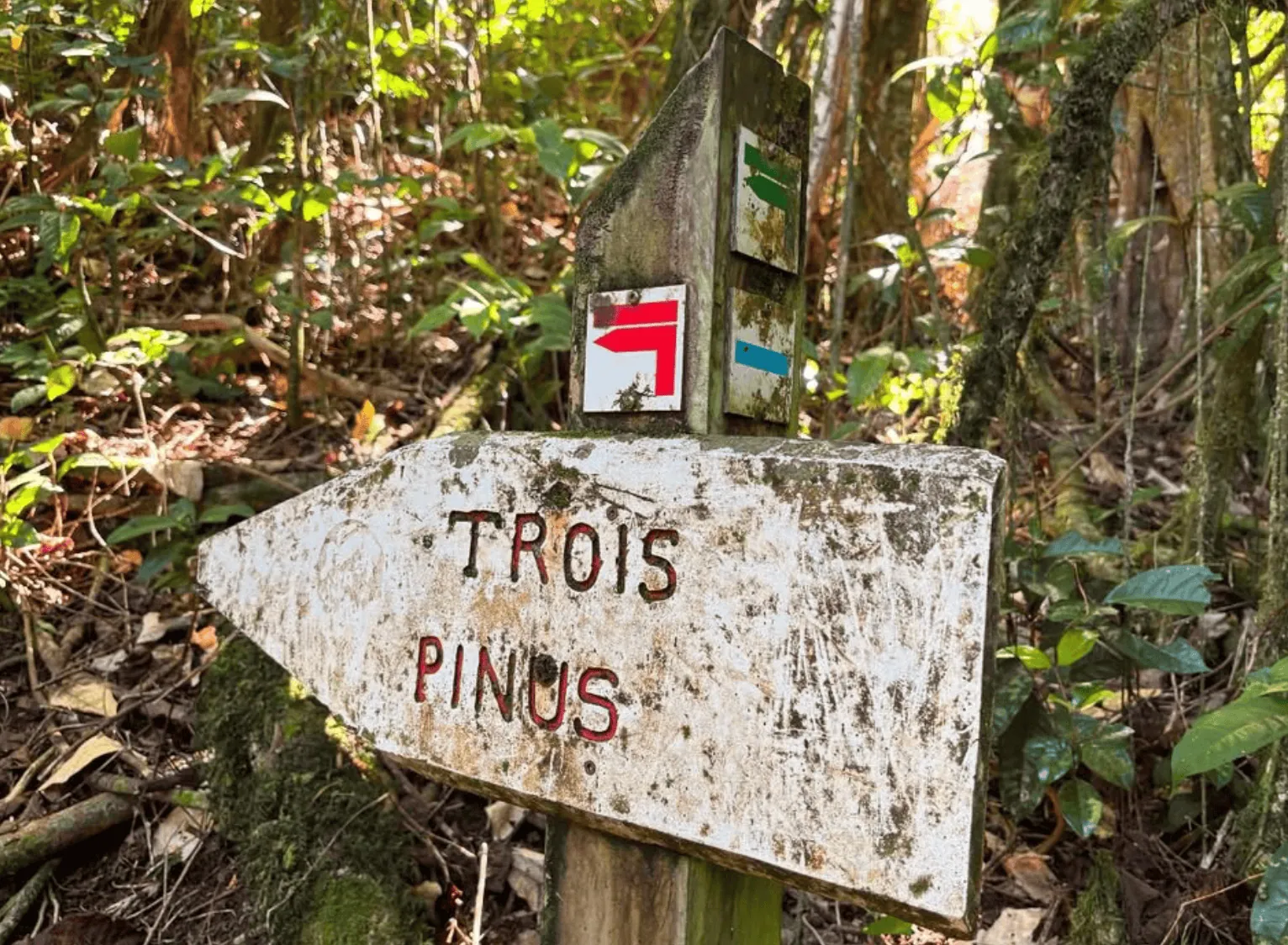
This lesser-known alternative to the Three Coconuts Trail offers a quieter, more secluded hike through Moorea’s lush tropical forest.
Starting from Belvedere Lookout, the trail winds through thick jungle, gradually gaining elevation along a well-shaded path.
Unlike other Moorea hikes, this trail sees fewer visitors, making it a peaceful escape into nature.
The first section follows a wide, well-maintained track, but as you climb higher, the trail narrows and becomes more rugged.
Expect to pass through dense bushes, crossing tree roots and rocky patches. As you approach the Three Pines Pass, you’ll notice a change in vegetation as pine trees begin to appear, a rare sight in Moorea’s otherwise tropical landscape.
At the summit, you’ll be rewarded with beautiful panoramic views of Opunohu Valley and Mount Rotui.
The lookout is slightly lower than the Three Coconuts Pass, but the vantage point offers a different perspective with equally stunning views.
👉 INSIDER TIP: This trail is much less maintained than other popular hikes on Moorea. Some sections are overgrown, and the lack of signals can make navigation tricky. Downloading an offline map or using a GPS app is recommended.
Afareaitu Waterfalls
- Length: 3.2 km (2 miles) out-and-back
- Summit: 180 meters (591 feet)
- Time to complete: 1.5–2 hours
- Difficulty: Easy to Moderate – Some uneven terrain, river crossings, and slippery sections
- Permit required? No, but a small entrance fee may be required if crossing private property
- Trailhead: Afareaitu village, near PK 8 on the east coast of Moorea
- AllTrails link: Afareaitu Waterfalls
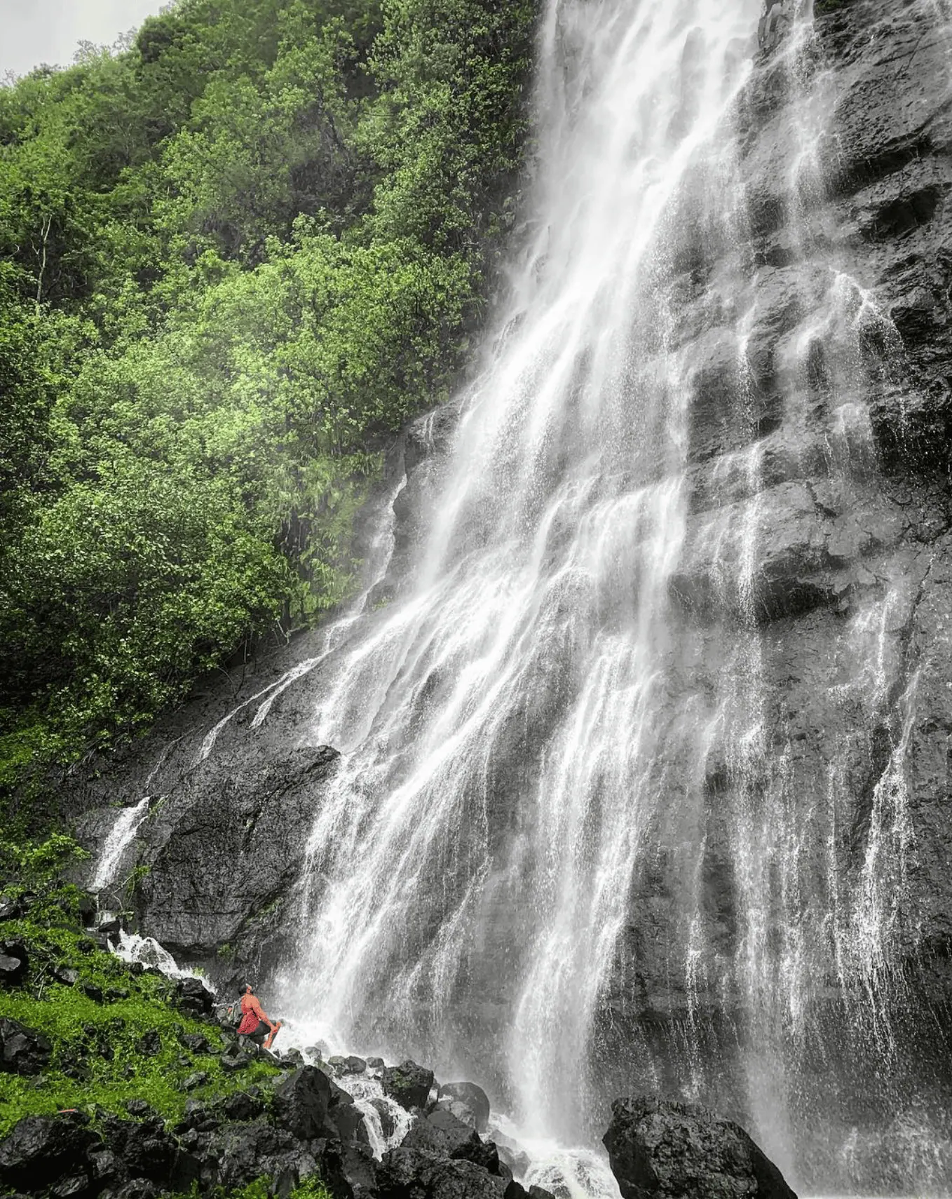
The Afareaitu Waterfalls hike is one of Moorea’s best short hikes, leading you to two stunning waterfalls hidden deep within the island’s jungle-covered mountains.
The trail begins near Afareaitu, a small village on Moorea’s east coast, and follows a lush rainforest path with plenty of shade along the way.
The hike starts on a wide dirt trail before narrowing into a more rugged jungle path. You’ll cross small streams and step over exposed tree roots, so expect to get your feet wet.
After about 20–30 minutes of hiking, you’ll reach the first waterfall, a 15-meter (49-foot) cascade pouring into a crystal-clear pool—perfect for a refreshing swim.
Continuing further, the second waterfall is even more impressive.
The final stretch requires a bit of rock scrambling, and the terrain becomes steeper and more slippery, but your effort is rewarded with a 30-meter (98-foot) waterfall, surrounded by lush tropical vegetation.
The pool beneath is deeper and cooler, making it a great spot for a swim before heading back.
👉 INSIDER TIP: Some sections of the trail pass through privately owned land, so bring cash (about 200 XPF / €1.70 / $2) in case they ask for a fee.
Simply fill in the form below to get a FREE QUOTE from trusted local travel specialists who know the islands inside out.
It only takes 60 seconds, and you’ll receive custom itineraries and pricing directly in your inbox or WhatsApp within
48 hours.
Free of charge. No pressure. No obligation.
*Our trusted local partners create every itinerary with care. We kindly ask that you submit a request only if you’re considering traveling.
Mount Rotui Hike
- Length: 7 km (4.3 miles) out-and-back
- Summit: 899 meters (2,949 feet)
- Time to complete: 5–6 hours
- Difficulty: Strenuous – Steep inclines, exposed ridges, and sections requiring scrambling
- Permit required? No
- Trailhead: Near the Hilton Moorea Lagoon Resort and Spa, on the opposite side of the road
- AllTrails link: Mount Rotui Trail
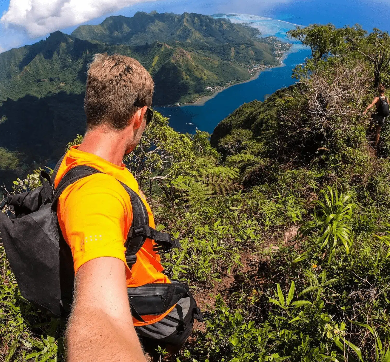
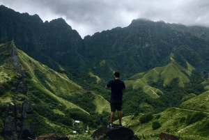
Mount Rotui stands as one of Moorea’s most challenging hikes, offering panoramic views of Cook’s Bay and Opunohu Bay.
The trail begins near the Hilton Moorea Lagoon Resort and Spa, with the trailhead marked by a sign reading “Rotui” in red.
The initial ascent takes you through dense tropical vegetation, gradually becoming steeper and more rugged.
As you progress, the path narrows, leading hikers along a razorback ridgeline with significant exposure on both sides.
This section demands sure-footedness and comfort with heights, as the drop-offs are huge.
The final push to the summit involves scrambling over rocks, but the effort is rewarded with 360-degree views of the island and its turquoise lagoons.
👉 INSIDER TIP: Given the trail’s exposure and the tropical sun, we advise you to start your hike early in the morning, preferably around 7:00 am.
Cautionary Note: The Mount Rotui hike has been the site of tragic accidents. In 2022, according to FranceInfo, a 34-year-old American tourist fell to his death while attempting the summit. Similarly, in the early 2000s, a group from Texas met a fatal accident when their climbing equipment failed during an ascent.
Vai’are to Paopao
- Length: 8.5 km (5.3 miles) point-to-point
- Summit: 460 meters (1,509 feet)
- Time to complete: 4–5 hours
- Difficulty: Moderate to Challenging – Steep inclines, jungle terrain, and some overgrown sections
- Permit required? No
- Trailhead: Vai’are, near the ferry terminal
- AllTrails link
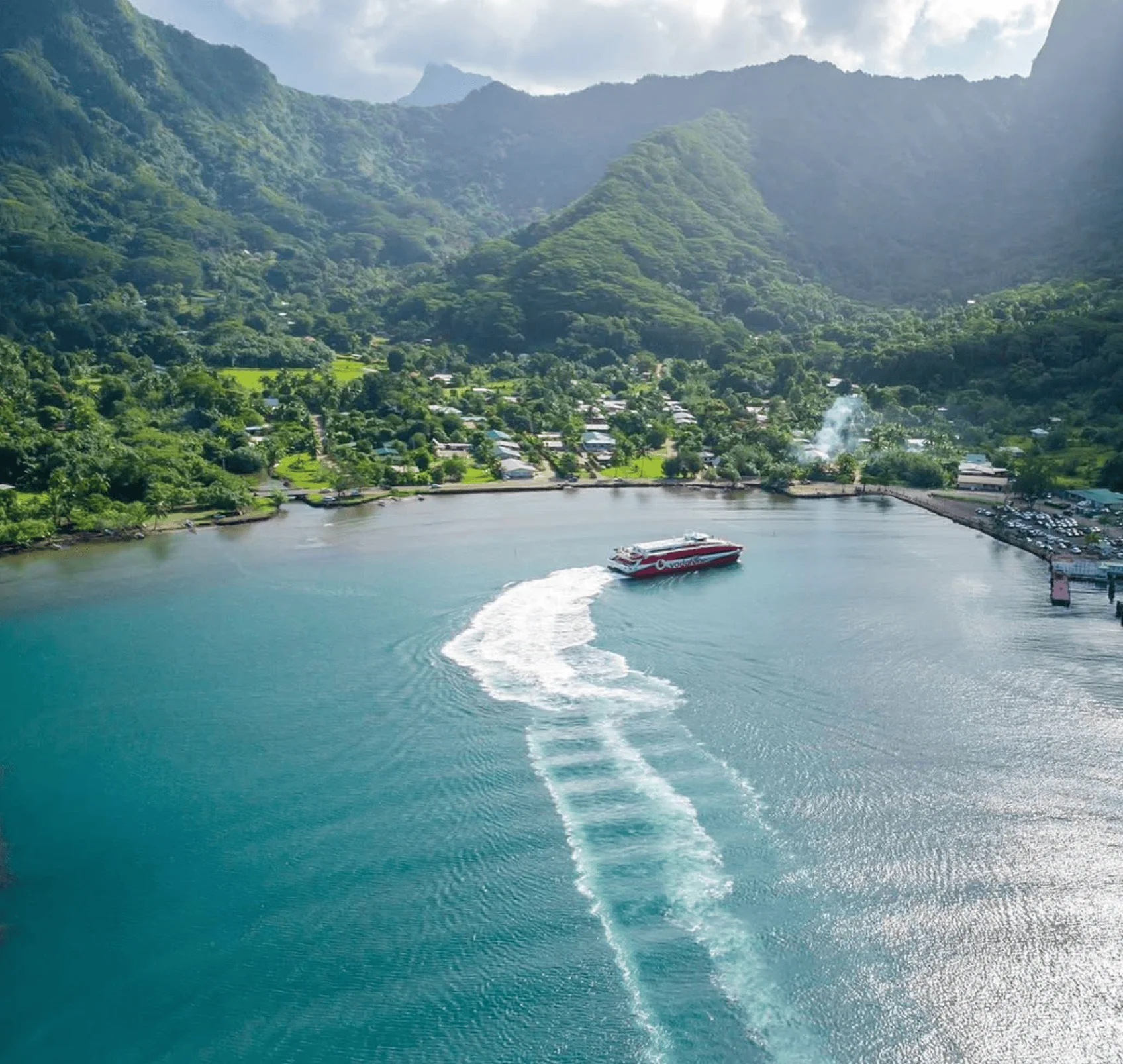
The Vai’are to Paopao hike is one of lesser-known Moorea hiking trails, offering a cross-island trek through the island’s interior, connecting the ferry town of Vai’are to the scenic Paopao Valley near Cook’s Bay.
This trail provides an authentic jungle experience, with steep inclines, thick vegetation, and stunning valley views along the way.
The hike begins near Vai’are, where you’ll start climbing immediately into the tropical rainforest.
The ascent is steep and relentless, with muddy switchbacks and narrow jungle paths.
After about 2.5 kilometers, you’ll reach the highest point at 460 meters (1,509 feet), where you’ll be rewarded with spectacular panoramic views of both Opunohu and Cook’s Bay.
From the summit, the trail descends toward Paopao Valley, passing through ferns, towering trees, and occasional clearings.
The descent is easier but still challenging, with some slippery sections if it has rained recently.
The trail eventually leads to a dirt road that connects to Paopao village near Cook’s Bay.
👉 INSIDER TIP: This trail is not well-marked, and overgrowth can make it difficult to navigate. It is highly recommended that you download a GPS track or offline maps before starting. Also, wild pigs are sometimes seen along the trail—make noise as you hike to avoid startling them.
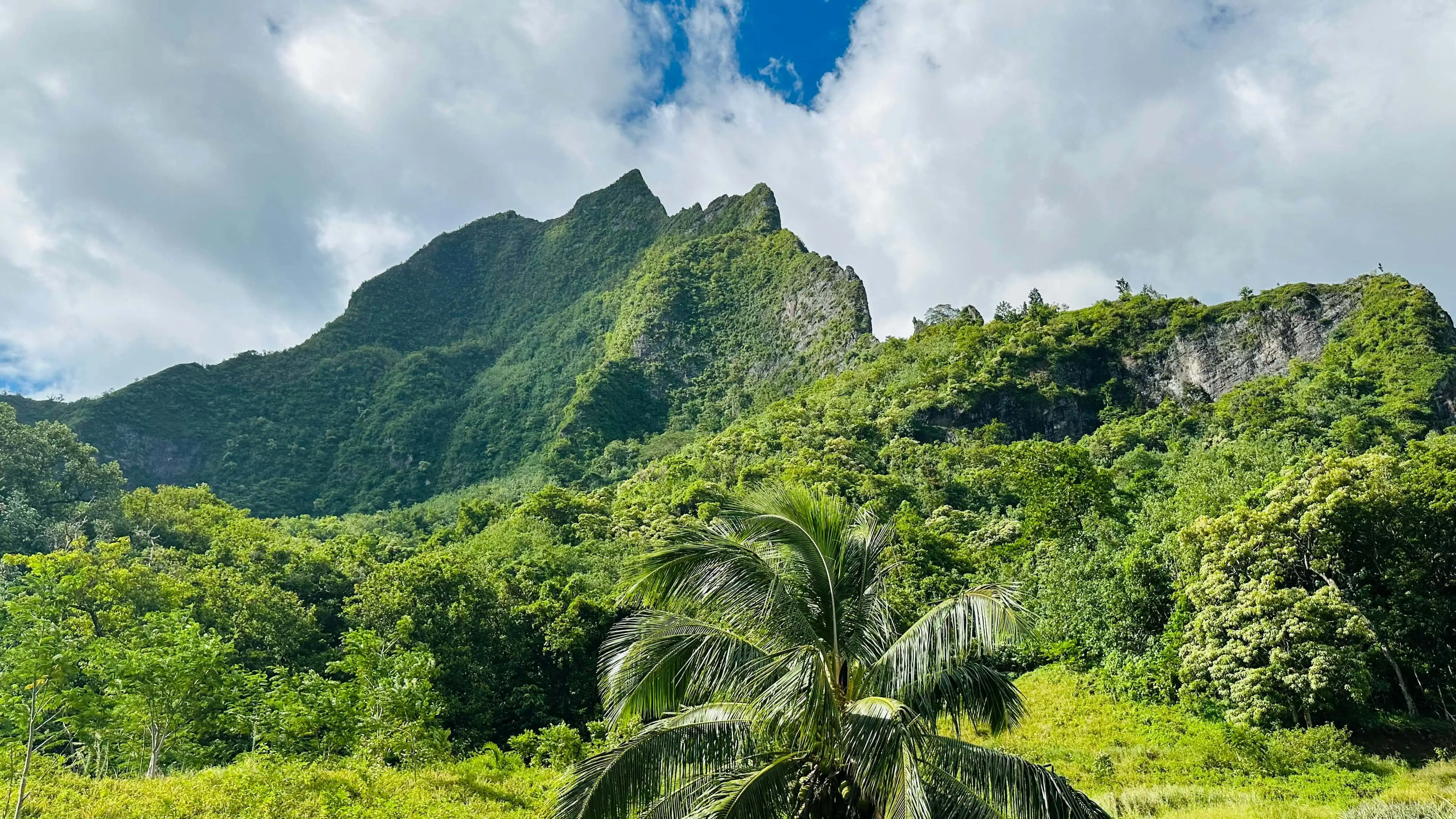
Mount Mou’aputa (Pierced Mountain)
- Length: Approximately 12 km (7.5 miles) out-and-back
- Summit: 830 meters (2,723 feet)
- Time to complete: 7–9 hours
- Difficulty: Strenuous – Steep inclines, exposed ridges, and sections requiring ropes and scrambling
- Permit required? No
- Trailhead: Afareaitu village, near the Vaioro River
- AllTrails link: Mou’aputa Trail

Mount Mou’aputa, also known as the “Pierced Mountain,” is one of Moorea’s most iconic peaks. It is easily recognizable by the distinctive hole near its summit.
According to Polynesian LEGEND, this hole was created when the warrior Pai threw a spear from Tahiti to prevent the theft of Mount Rotui by the god Hiro, piercing Mou’aputa in the process.
The hike to Mou’aputa is challenging and recommended only for experienced hikers.
The trail begins in the village of Afareaitu, following the Vaioro River past the Afareaitu Waterfall.
The initial portion involves a steep ascent through dense forest, with sections requiring fixed ropes.
As you approach the summit, the path becomes more exposed, with narrow ridges and significant drop-offs.
The effort is rewarded with 360-degree panoramic views of Moorea, including Mount Rotui, Cook’s Bay, and Opunohu Bay.
Simply fill in the form below to get a FREE QUOTE from trusted local travel specialists who know the islands inside out.
It only takes 60 seconds, and you’ll receive custom itineraries and pricing directly in your inbox or WhatsApp within
48 hours.
Free of charge. No pressure. No obligation.
*Our trusted local partners create every itinerary with care. We kindly ask that you submit a request only if you’re considering traveling.
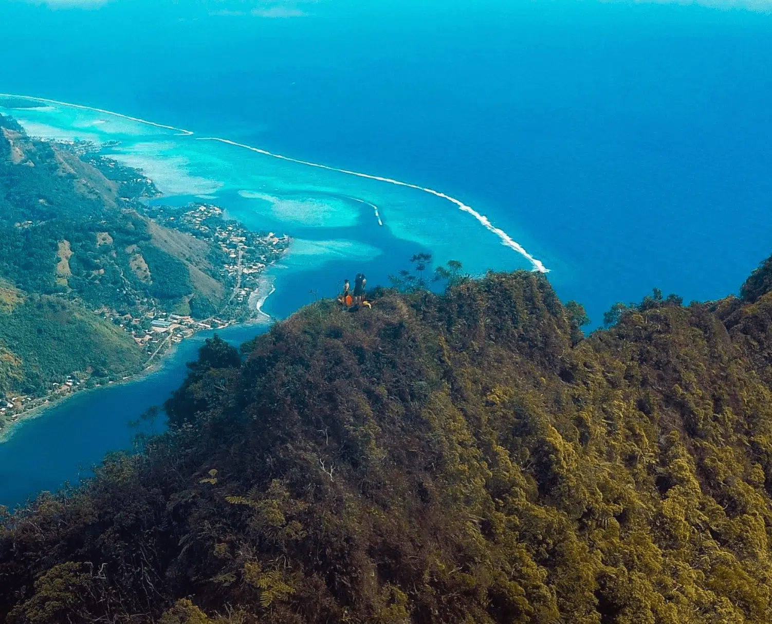
Paaruiti (Mount Paaru Iti)
- Length: 4.8 km (3 miles) out-and-back
- Summit: 599 meters (1,965 feet)
- Time to complete: 3 hours
- Difficulty: Challenging – Steep inclines, overgrown sections, and technical terrain
- Permit required? No
- Trailhead: Near Temae, Moorea
- AllTrails link
Mount Paaru Iti, known as Paaruiti, offers a challenging ascent through Moorea’s rugged interior. The summit offers panoramic views of the island’s northern coastline and the Pacific Ocean.
This hike is not for beginners; it requires climbing, navigating overgrown paths, and handling steep ridges.
However, for those up to the challenge, the rewarding summit experience makes it one of the most spectacular hidden gems on the island.
First Lookout
The trail begins near Temae, with the trailhead located near a local building—some hikers report having to navigate around a gate to access the path.
The first section is a steep and relentless climb through a thick jungle with exposed tree roots and muddy patches.
You may need to use ropes in some sections.
After about 30–40 minutes, you’ll reach the First Lookout, a rocky clearing offering partial coastline views.
This is a good place to rest and assess the remaining climb, as the most challenging sections lie ahead.
The ridgeline leading to the summit is steeper and more technical, with sections requiring scrambling over rocks and navigating narrow, exposed paths.
To the summit
Beyond the First Lookout, the trail becomes more rugged and overgrown, leading to a sharp ridgeline with sheer drop-offs on both sides.
The final push to the summit is steep and physically demanding, requiring careful footing and steady balance.
At 599 meters (1,965 feet), the summit rewards you with 360-degree views of Mount Rotui, Opunohu Bay, and the Pacific Ocean.
On clear days, you can see across the island to Cook’s Bay and even spot the distant peaks of Tahiti.
👉 INSIDER TIP: Since the trail is overgrown and not well-marked, download an offline GPS map before your hike. Some hikers have reported getting lost on the way down due to unclear paths.
Vaiare Pass (Col de Vai’are)
- Length: 9.6 km (6 miles) point-to-point
- Summit Elevation: 300 meters (984 feet) from Belvedere; 550 meters (1,804 feet) from Vaiare
- Time to Complete: 3.5 hours from Belvedere; 4 hours from Vaiare
- Difficulty: Intermediate – Well-marked paths with steep sections, especially approaching the pass from Vaiare
- Permit Required: No
- Trailheads: Belvedere Lookout in Opunohu Valley or near the ferry terminal in Vaiare
- AllTrails Link: Col de Vai’are
The Vaiare Pass, or Col de Vai’are, offers you a scenic cross-island trek on Moorea, connecting the Opunohu Valley to the village of Vaiare.
Starting from Belvedere Lookout:
- Descent: Begin at the Belvedere Lookout, following the trail toward the Three Pines Pass (Col des Trois Pinus). The path is well-marked and shaded, winding through dense forest and passing historical sites like ancient marae (Polynesian temples).
- Ascent to the Pass: After 2.2 km (1.4 miles), you’ll cross a stream and continue through a bamboo grove. The trail then ascends gradually toward the Vaiare Pass, offering clearings with views of the caldera and surrounding peaks.
- Descent to Vaiare: The descent toward Vaiare is steeper, with some sections requiring careful footing, especially after rain. The trail eventually transitions into a dirt track leading directly to the village and ferry terminal.
Starting from Vaiare:
- Ascent: From the ferry terminal, head west, following signs toward the trailhead. The initial section involves a steep climb through forested terrain, with the path becoming more moderate as you approach the pass.
- Descent to Belvedere: After reaching the pass, the trail descends gently toward the Belvedere Lookout, passing through diverse ecosystems and offering views of Cook’s Bay and Opunohu Bay.
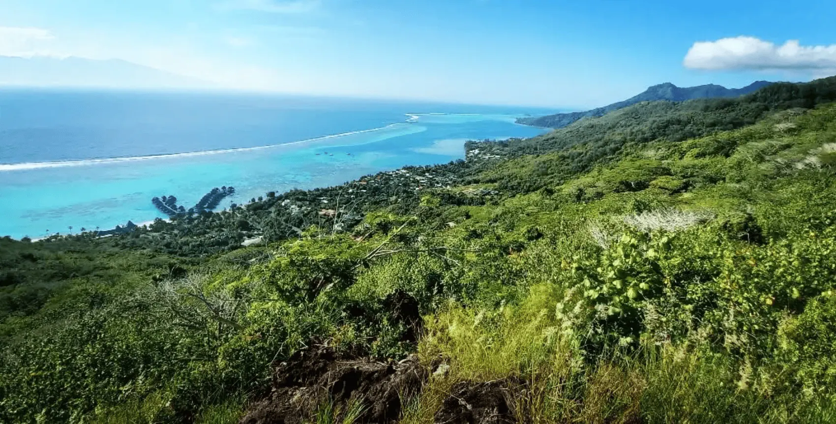
Toatea Lookout
- Elevation: 70 meters (230 feet)
- Accessibility: Easily reachable by car, bike, or a short walk from nearby accommodations
- Permit required? No
- Location: Near the Sofitel Kia Ora Moorea Beach Resort, overlooking Temae Beach
- Google Maps link: Toatea Lookout on Tripadvisor

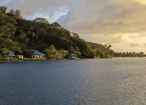
Toatea Lookout is one of Moorea’s most stunning viewpoints. It offers panoramic vistas of the island’s turquoise lagoon, the overwater bungalows of the Sofitel Resort, and the distant silhouette of Tahiti.
Toatea Lookout is a quick traveler stop just off the main coastal road.
If you’re arriving from the ferry terminal in Vaiare, it’s a short 10-minute drive heading northwest.
Parking is available directly at the lookout.
Best time for hiking in Moorea
During the dry season, the best time hiking in Tahiti is between May and October.
This period offers more stable weather and drier Moorea hiking trails, reducing the risk of slipping.
For a full, rewarding experience of the incredible views, start your hike around 5:00 a.m. so you reach the summit before the clouds arrive around 10 a.m., blocking the breathtaking panoramas.
Emergency Contacts when hiking in Moorea
If you have an emergency while hiking in Tahiti, call 17 for police assistance and 15 for medical help.
Practical hiking tips
Moorea’s hiking trails offer breathtaking views, dense rainforests, and challenging ridges, but the island’s tropical conditions require proper preparation.
Here’s how to make the most of your hike:
- Start early—The best time to hike is before 8 a.m. when the temperature is cooler and the Moorea hiking trails are less crowded.
- Check the weather – Avoid hiking after heavy rain, as Moorea hiking trails can become muddy and slippery.
- Download offline maps – Some trails are poorly marked or overgrown, so having an offline GPS map (like AllTrails or Maps.me) is crucial.
- Inform someone of your plans – Cell reception is unreliable, especially in the valleys and ridgelines. Let someone know your estimated return time.
- Pace yourself – Many Moorea hiking trails involve steep climbs and scrambling. Take your time, especially on ridges with significant drop-offs.
👉 INSIDER TIP: The Moorea hiking trails often start on private land. Some landowners may ask for a small entrance fee (200 XPF / €1.70 / $2)—so bring some cash just in case.
Simply fill in the form below to get a FREE QUOTE from trusted local travel specialists who know the islands inside out.
It only takes 60 seconds, and you’ll receive custom itineraries and pricing directly in your inbox or WhatsApp within
48 hours.
Free of charge. No pressure. No obligation.
*Our trusted local partners create every itinerary with care. We kindly ask that you submit a request only if you’re considering traveling.